
Striking Overland Gold: Exploring the Lost Sierra
- Ben Easley
- Jul 1, 2024
- 7 min read
Lost Sierra 4x4 Trail Info The Lost Sierra 4x4 Trail is a 200+ mile overland track through some of the most productive mining districts in the Sierra Nevada. The route features bumpy jeep roads, numerous stream crossings, dozens of lakes, and exquisitive views of the surrounding northern Sierra Nevada. Please visit the Lost Sierra 4x4 Trail Route Guide page for more info, including the GPX file.

Nestled among the northern reaches of the Sierra Nevada range, the Lost Sierra is steeped in Gold Rush and early American history. Set amid the beautiful peaks of northern Sierra, Sierra and Plumas counties form the heart of the Lost Sierra. Home to dozens of historic mining towns and communities, towns like Downieville, Greenville, Graeagle, Portola, Quincy, and Sierraville continue to thrive today thanks to a boom in tourism and outdoor recreation. While the gold fields of the central Sierra seem to claim much of the glory when it comes to California's Gold Rush, the gold fields of the Lost Sierra were incredibly rich and productive. Mining districts like Allegheny and Howland Hill produced exceptionally rich ore. Reports even indicate that a Chinese miner pulled a 61-pound gold nugget out of Slate Creek in 1901.
Today, most who visit the Lost Sierra come for its many outdoor recreation opportunities. Hiking, mountain biking, camping, fishing, off-roading, and overlanding are all quite popular. With more people flocking to the Tahoe Basin, more folks are heading north to the Lost Sierra to escape the traffic and crowds. This one-time secret Shangri-La in the northern Sierra has been discovered. However, that should hardly dissuade those looking to explore the Lost Sierra backcountry, where people are far and few between. And the best way to explore the Lost Sierra? That would be the 204 mile Lost Sierra 4x4 Trail of course!
The Lost Sierra 4x4 Trail
The Lost Sierra 4x4 Trail is a 200+ mile overland trek through some of the northern Sierra's most iconic landscapes. With opportunities to explore and camp at old mining camps and ghost towns, numerous opportunities for lakefront camping, and miles of rocky trails, the Lost Sierra 4x4 Trail is definitely one of my favorite overland tracks in northern California. Given the rugged nature of some of the trails, a stock 4x4 with a solid set of all-terrain tires is recommended.

We begin our adventure on Highway 49 near Downieville, above the ice-cold water of the Yuba River. Named after William Downie, Downieville came to be after gold was discovered in the area in 1849, and with the arrival of nearly 5,000 prospectors by 1850, Downieville was officially on the map. Turning off the pavement of the highway, the dirt road soon narrowed as we climbed into the high country. The first stop of our multi-day adventure would be Saddleback Mountain, one of the few remaining fire lookouts in the state that still works by human effort rather than cameras and electronic equipment. During our visit, we were lucky enough to be given a tour by Tony, who seems to be quite well-known around these parts. From Saddleback Mountain, we'd spice things up a bit with the always-popular Poker Flat Trail.

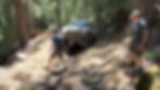
The Poker Flat Trail makes haste work of the mountain, quickly descending down to the creek where the old Poker Flat mining camp was located in the 19th century. Today, a dilapidated old shack stands as a testament to those that came to this land in search of gold in the hills, rivers, and creeks. The climb out of Poker Flat is filled with numerous sections of trail that are steep, rutted, and filled with loose rock. Combine that with a bit of water and mud, and you'll find your rig anxiously searching for traction if you don't pick the right line. With our rigs engaged in 4-low, we slowly made our way towards the top of the hill, where an old ghost town awaits.
Howland Flat and neighboring Potosi were once home to thousands of prospectors. At its peak, Howland Flat housed several thousand inhabitants, three saloons, mercantile shops, a school, a post office, and a hotel. Many of these old buildings still stand today, including the crumbling stone walls of the Wells Fargo Express Office. However, it's not the old dilapidated buildings that attract most visitors these days, but rather the well-maintained historic pioneer cemetery. And if you really want to tap into the ghosts that wander the woods of yesteryear, consider staying at the campsite just across the way (that was a hard no for our group!).

From Howland Flat, we'd continue along the track passing through the old mining camps of St. Louis, Gibsonville, and La Porte. Around every corner and bend remain the telltale signs of an environmentally destructive mining past. Entire hillsides that were blasted with powerful hydraulic cannons 150+ years ago remain barren and scar the otherwise beautiful forested slopes. Mine tailings (piles of rock and gravel) stretch for miles around many of the old mining districts, and one can't help but wonder how those struck with gold fever managed to move so much earth with rather crude mining tools and techniques.
As the sun sank lower on the horizon, finding a suitable camp for our half dozen or so rigs quickly became the priority. It seemed that all of the best spots were taken for several miles in every direction. So, we started to explore various spur roads, eventually settling on an open serpentine barren above Slate Creek. Later that evening, we were paid a visit by a man on an ATV with a small trailer in tow. He explained that he owns and manages a Christian summer camp just over the knoll and regularly visits the serpentine barren to prospect for gold. His tools of choice: an old heavy duty shop vac and water sluice back at camp. The friendly stranger also claimed that Slate Creek had produced massive gold nuggets in the past, and that some old-timers continued to work their claims along the creek. The kids in the group were given the opportunity to vacuum up several buckets of dirt, which would be run through the water sluice to check for any nuggets or gold flakes. Our newly made friend returned the next morning, providing each child with a small jar containing a small amount of gold flakes. The kids had become official prospectors, and they loved it!

We arose bright and early the next day and began working our way eastward along the Lost Sierra loop. The section of the trail that dissects Mt. Fillmore and Mt. Etna is one of the prettier sections of the route. We'd make a quick lunch stop at McRae Meadows and a short out-and-back trip to the Lakes Basin viewpoint before descending down the mountain to Plumas-Eureka State Park. As you make your way past Mt. Etna, you get the sense the old mining camps and districts are behind you. But the Jamison mining district at Plumas-Eureka State Park is easily the most impressive along the Lost Sierra 4x4 Trail. The state park features numerous buildings that have been renovated for visitors, and the massive Mohawk Stamp Mill (unfortunately, it has not been renovated) is quite a sight to behold. During the summer months, the state park offers visitors the opportunity to pan for gold, and if you visit on weekends, you may even catch one of the volunteers working the old blacksmith shop.

The day was capped off with a short hike to Frazier Falls. Normally the 176 foot tall cascade is flowing with plenty of water in early summer. But after another year of drought, the falls were a shadow of their normal self. Even though water wasn't thundering down and over the cascades, the group enjoyed the short hike and viewing platform.

We'd continue on our journey in search of camp. After identifying several prospective camps in the Church Meadows area, it took several attempts and well over an hour to find a respectable campsite with a small mosquito population. We eventually found a clearing with a fantastic view of the Sierra Buttes in the distance. Not bad, eh?

The next day found us visiting some of the more scenic and busier locations in the Lost Sierra. We'd begin our day with a short trip up to Mills Peak Lookout. Mills Peak provides fantastic views of the Sierra Buttes, Lakes Basin, and Lost Sierra. From Mills Peak, we'd head into the heart of the Lakes Basin Recreation Area, which meant crowds. The convoy crossed onto the pavement and made a beeline for Upper Sardine Lake. The road to the lake is a bumpy jeep track best driven in 4-low to manage speed. The parking lot at the beginning of the trail was brimming with visitors, but the crowds thinned out upon our arrival at the lake. With the Sierra Buttes as its backdrop, it's no wonder hundreds of visitors hike, bike, and drive to Sardine Lake every day during the warm season. The kids enjoyed throwing dozens of rocks into the lake, and after an hour or so, we reluctantly agreed it was time to continue our adventure.

From Upper Sardine Lake, we'd follow the pavement to Gold Lake. Gold Lake would lead us to a series of tight and rocky jeep tracks, including the impressive stretch of trail simply known as Lots-o-Lakes, which features stunning views of the dozen or so lakes within the Lakes Basin Recreation Area. Lots-o-Lakes follows a ridgetop with dozens of campsites, most with impressive views of the surrounding mountains. But since we were out on a holiday weekend, just about every site was occupied. Lots-o-Lakes eventually spills out at Packer Saddle, the start of the famed Downieville Downhill mountain bike trail. From Packer Saddle, our final destination, the Sierra Buttes Lookout, stood menacingly before us.

At 8,591 feet, the Sierra Buttes dominate the relatively tame northern Sierra. Unlike the jagged buttes and snow-capped peaks of the central and southern Sierra, the northern Sierra dissipates into a series of mountains typically ranging from 5,000 to 7,500 feet in elevation. The massive rock faces of the Sierra Buttes are an anomaly in this part of the Sierra, and it's no wonder why people flock to the area. To get to the lookout that sits atop the buttes, one must first drive up a series of dirt roads. The trail is loose, rocky, and steep as hell. The grade up the trail exceeds 25 degrees in several locations, and once you make it through the steep and dusty section, you'll need to navigate a series of hairpin turns on an exposed shelf road. If you're scared of heights, driving to the lookout isn't recommended!

A steel gate impedes vehicle passage, so the last two hundred yards must be traversed on foot. The lookout sits atop a massive boulder at the buttes' summit. A series of steel staircases and ladders cling to the craggy buttes, eventually leading to the lookout. After about 180 steps, you're rewarded with impressive 360-degree views of the northern Sierra. On a clear day, you can even see Lassen Peak to the north. The track ends with a white-knuckle descent down a shelf road to Sierra City.