
Vancouver Island Grand Loop
- OTG Crew
- Oct 8, 2024
- 7 min read
Updated: Dec 22, 2025
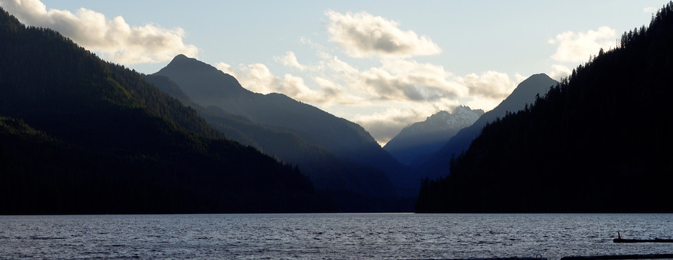
The Vancouver Island Grand Loop is a 1,000-mile (1,700 km) scenic soft-roading adventure, perfect for adventurers looking to explore the island’s stunning coastlines, remote beaches, and charming towns. The route takes you through backroads, bypassing many of the major highways to reveal hidden gems and breathtaking views.
Route Overview
Trip Length & Season
Adventure Rating: Epic Trip Length: 1,007 miles, 6-14 days Season: The best time to visit Vancouver Island is typically late spring to early fall. While the route can be traveled during the wet season, keep in mind that the northwest portion of Vancouver Island experiences 100+ inches of annual rainfall, and up to 200 inches during exceptionally wet years. The wet season runs from November to May.
Digital Maps & GPX Files
Download Digital Mapping Files
Vancouver Island Grand Loop w/ POIs (for Subscribers)
If you need help working with digital mapping and GPX files, please check out our FAQ section.

Technical Ratings & Terrain
Avg Technical Rating: 1
Peak Technical Rating: 2
Typical Terrain: The terrain is about 50% pavement and 50% dirt. The dirt sections are primarily well graded dirt and gravel roads that we'd qualify as softroading.
Recommended Vehicle / Moto / Adventure Vans
Recommended Vehicle: Stock 4x4
Recommended Moto: Big bike.
Adventure Vans: Sprinter 4x4s are good to go!
Fuel, Provisions, and Recommended Gear
Fuel: Fuel is plentiful throughout the route, typically never more than 30-40 miles away. Provisions: Provisions can be obtained in the same general vicinity as fuel. Gear: no specialized gear is recommended for this adventure.
Alternative Routes
Tofino Track
Distance: 96 miles (one way)
Technical Rating: 1-2 The Tofino Track will take adventurers to some of Vancouver Island's most remote and beautiful coastline. While the majority of the track is pavement, there is an opportunity to get off and explore the around Ucluelet and Mussel Beach area.
Tree to Sea Drive
Distance: 39 miles (one way)
Technical Rating: 1-2
This scenic drive along dirt and gravel roads takes adventurers to remote intlets and bays, eventually leading to the outpost of Tahsis. Folks looking to really get off the beaten path should consider this track.
Fair Harbour Track
Distance: 120 miles
Technical Rating: 1-2 The Tofino Track will
Follow the dirt roads along the Zeballos River which eventually leads to the outpost of Zeballos. Continue along to reach the uber remote outpost of Fair Habour
Grant Bay Track
Distance: 22 miles (one way)
Technical Rating: 2 This track leads to the incredibly idylic Grant Bay, but like San Jose Bay and Beach, you'll need to make a short hike from the parking lot in order to reach the beach. You may also wish to visit the remote seaside outpost of Winter Harbour that's a couple miles off the track.
Rock Bay Track
Distance: 44 miles
Technical Rating: 1-2
As you head further south, there are fewer and fewer opportunities to explore the remote eastern coastline of Vancouver Island. The Rock Bay Track is the most southern dirt track that can be explored on the Vancouver Island's eastern coastline. The track featureres a number of large lakes and various recreation sites, including three right on the coast.
Camping Recommendations
With its dense forests and limited public lands, dispersed camping is a bit more challenging than you might imagine, especially compared to mainland BC. However, there are still hundreds of great campsites along the loop, including many remote recreation sites. The northern half of the Vancouver Island tends to have many beaituful and remote sites and campgrounds. Some of our favorite places to camp include:
Blackies Beach recreation site (Nahmint Lake)
Ralph River campground
Cougar Creek recreation site (Tree to Sea drive)
Conuma River recreation site (Tree to Sea drive)
Vernon Lake recreation site
Woss Lake recreation site
Atluck Lake recreation site
Kathleen Lake recreation site
Pinch Creek recreation site (Alice Lake)
Spruce Bay recreation site (Victoria Lake)
Side Bay recreation site
Gooding Cove recreation site (near Side Bay)
Holberg Inlet
Spencer Cove recreation site (near Quatsino Prov. Park)
Georgie Lake
Naka Creek Recreation Site (north of Eve River)
Ida Lake recreation site
Anutz Lake recreation site
Schoen Lake Provincial Campground
Tlowils Lake recreation site
McCreight Lake recreation site
Pye Lake recreation sites
Stella Bay recreation site
Little Bear Bay Recreation Site
Elk Bay recreation site
McMullen Point recreation site
Brewster Lake recreation site
Campbell Lake recreation sites
Big Bay creation site
Most recreation sites require a fee for camping.
Discovery Points
DP1 - Beacon Hill
DP2 - Holland Point Park
DP3 - The Breakwater Lighthouse
DP4 - Victoria Harbour
DP5 - Victoria
DP6 - Songhees Point Park
DP7 - Fisgard Lighthouse
DP8 - Sitting Lady Falls
DP9 - Sooke River
DP10 - Sooke Region Museum
DP11 - West Coast Road
DP12 - Seringham Point Lighthouse
DP13 - Sandcut Beach & Falls
DP14 - Jordan River
DP15 - San Juan River
DP16 - Red Creek Fir
DP17 - Fairy Lake Tree
DP18 - Gordon River
DP19 - Avatar Grove & Gnarliest Tree
DP20 - Cowichan Lake
DP21 - Town of Lake Cowichan
DP22 - Nitinat River
DP23 - Pachena Beach
DP24 - Bamfield, BC
DP25 - Sarita River
DP26 - Sarita Falls
DP27 - Alberni Inlet
DP28 - Port Alberni
DP29 - Habour Quay Park
DP30 - Somass River
DP31 - Cathedral Grove
DP32 - Cameron Lake
DP33 - Little Qualicum Falls
DP34 - Trent River Falls
DP35 - Puntledge River
DP36 - Stotan Falls
DP37 - Oyster River
DP38 - Upper Campbell Lake
DP39 - Elk River
DP40 - Gold River, BC
DP41 - Gold River
DP42 - Muchalat Lake
DP43 - Vernon Lake
DP44 - Nimpkish River
DP45 - Woss River
DP46 - Atluck Lake
DP47 - Tahsish River
DP48 - Devil's Bath
DP49 - Benson River
DP50 - Eternal Fountain
DP51 - Victoria Lake
DP52 - Port Alice, BC
DP53 - Neroutsos Inlet
DP54 - Coal Habour, BC
DP55 - Holberg Inlet
DP56 - Scarlet Ibis Pub
DP57 - Goodspeed River
DP58 - San Josef Beach
DP59 - Shoe Tree
DP60 - Port Hardy, BC
DP61 - Quatse River
DP62 - Queen Charlotte Strait
DP63 - Cluxewe River
DP64 - Port McNeill, BC
DP65 - Kokish River
DP66 - Telegraph Cove, BC
DP67 - Bonanza Lake
DP68 - Eve River
DP69 - Adam River
DP70 - White River
DP71 - Salmon River
DP72 - Memekay River
DP73 - Brewster Lake
DP74 - Campbell River
DP75 - Elk Falls
DP76 - Campbell River, BC
DP77 - Maritime Heritage Centre
DP78 - Comox
DP79 - Courtenay River
DP80 - Parksville
DP81 - Pipers Lagoon Park
DP82 - Salish Sea
DP83 - Nanaimo
DP84 - Chemainus River
DP85 - Old Stone Butter Church
DP86 - Cowichan Bay Lookout
DP87 - Mt Doug Viewpoint
DP88 - Beach Drive
DP89 - Cattle Point
DP90 - Clover Point
Land Managers & Other Resources
Permits & Papers
Passports & Auto Insurance If you're traveling from outside of Canada, you'll need your passport in order. Most US auto insurance policies extend their coverage into Canada, but be sure to check! Getting to Vancouver Island You'll need to purchase tickets from BC Ferries to transport your vehicle to and from Vancouver Island. There are two different ports from Vancouver that have ferries to Vancouver Island.
Adventure Badge
OTG has partnered with All Roads Taken to offer an adventure badge for this route.

Route Details
The 1,000+ mile Vancouver Island Grand Loop is a soft-roading adventure through some of the island’s most scenic and remote locations—places that few tourists or locals ever visit. With over 2,000 miles of coastline and tens of millions of forested mountain acres, Vancouver Island is a paradise for outdoor recreation. Although the island lacks the same level of public access to dirt roads and trails as mainland BC, BC Parks has developed numerous recreation sites (semi-developed campgrounds often with a picnic bench and fire ring) across the island, including those in lesser-visited areas.
Most travelers arrive in Victoria via ferry (see Permits and Papers above for BC Ferries info). Founded in 1843 as a Hudson Bay Company trading post, Victoria is rich in pioneer and gold rush history. Before heading north along the scenic coastlines, take some time to walk Victoria’s historic downtown and explore its coastal parks. Leaving Victoria, the track joins the scenic West Coast Drive, which hugs the island’s western coastline.
Upon reaching the bay of Port San Juan, the track heads inland on a dirt road leading to the scenic Cowichan Lake, then follows a mix of dirt and paved roads through First Nations’ lands and along the beautiful Alberni Inlet coastline. For those seeking rugged Vancouver Island scenery, the 96-mile Tofino Track (see alternative routes) is a worthwhile detour.
As central Vancouver Island is largely inaccessible by vehicle, the track moves to the east coast before returning west into the mountains. Passing numerous lakes, glacier-carved valleys, and remote outposts like Gold River, the track offers additional alternative routes (Tree to Sea Drive, Fair Harbour Track, Side Bay Track, Grant Bay Track) for those wanting to explore some of BC’s most spectacular, secluded coastlines.
The island’s northern end, where annual rainfall can exceed 200 inches, offers fewer people and more dirt and gravel roads through emerald forests. The track reaches its northwestern apex at San Josef Bay—though a short hike is required, the rugged northern coastline is worth the effort.
As you travel south along the eastern coastline, the track weaves between interior routes and coastal paths. Quaint villages like Port Hardy, Port McNeill, and Campbell River dot the coastline. Around Campbell Lake, you’ll find some of the island’s best camping. Upon reaching Campbell River, expect a quicker pace as the route shifts primarily to paved roads. Take advantage of discovery points along the way, especially in historic towns like Parksville and Nanaimo.
The track winds around Cowichan Bay and back to greater Victoria. If time allows, we highly recommend hiking at Thetis Lake Regional Park. The track wraps around Victoria’s eastern coast, offering opportunities to explore local parks, lighthouses, and viewpoints like Mt. Doug, with one of the best views of Victoria and the San Juan Islands. The loop completes at the famous Beacon Hill viewpoint.
GALLERY


Terms of Use: Should you decide to travel a route that is published on Overlandtrailguides.com, you do so at your own risk. Always take the appropriate precautions when planning and traveling, including checking the current local weather, permit requirements, trail/road conditions, and land/road closures. While traveling, obey all public and private land use restrictions and rules, and carry the appropriate safety, recovery, and navigational equipment. The information found on this site is simply a planning resource to be used as a point of inspiration in conjunction with your own due-diligence. In spite of the fact that this route, associated GPS track (GPX and maps), and all route guidelines were prepared under diligent research by OverlandTrailGuides.com, the route accuracy and current conditions of roads and trails cannot be guaranteed.