
Trinity Alps Backcountry Discovery Trail
- OTG Crew
- Jun 9
- 8 min read
Updated: Jul 7
The Trinity Alps Backcountry Discovery Trail threads through the heart of one of the most geologically wild and botanically bizarre corners of North America, connecting the Sacramento River drainage to the deep canyon country of the Salmon River along the way. Ancient gold mining history, snow-capped alpine lakes, fire lookouts with views that stop you cold, and a stretch through the rarely visited Russian Wilderness make this one of the finest overland routes in Northern California.


Route Overview
Trip Length & Season
Adventure Rating: Epic Trip Length: 297 mi, 3-6 days Season: June thru October is the safe bet, but the route may be open earlier/later in the season depending on seasonal weather (snow).
Digital Maps & GPX Files
Download Digital Mapping Files
If you need help working with digital mapping and GPX files, please check out our FAQ section.

Technical Ratings & Terrain
Avg Technical Rating: 2-3
Peak Technical Rating: 4
Typical Terrain: This route consists of a pathwork of dirt and interconnecting pavement sections. The vast majority of dirt consists of mellow dirt roads, some narrower dirt roads with shelf roads. There are a few bumpier sections, namely the out-and-back to Tamarack Lake.
Recommended Vehicle / Moto / Adventure Vans
Recommended Vehicle: Stock 4x4
Recommended Moto: A full size or mid-weight bike should be fine. If you're on a big bike you may wish to skip the rocky out-and-back to Tamarack Lake.
Adventure Vans: Sprinters and Transits (4x4/AWD) can do the route with one small adjustment-- skip the out-and-back section to Tamarack Lake.
Fuel, Provisions, and Recommended Gear
Fuel:
From Dog Creek Road to Trinity Center is 60 mi
Trinity Center to Etna is 170 mi
Etna to Cecilville is 95 mi or Etna to Orleans is 100 mi
Provisions: Provisions can be obtained in the same general vicinity as fuel. Gear: n/a
Alternative Routes
Eastside Road Distance: 7 miles Technical Rating: Paved
The southern approach to Bonanza King Lookout passes through private timberland. In some cases the gate may be locked and closed on the southern approach to the summit. If this is the case, please use Eastside Road to reach the northern approach to Bonana King (Scorpion Creek Road), which should be accessible.
Camping Recommendations
The Trinity Alps BDT features an incredible amount of dispersed camping options. Some of our favorite places to camp include:
East Fork of the Trinity
Bear Flat
Tamarack Lake
Gumboot Lake
Cliff Lake
Kangaroo Lake campground
Carter Meadows dispersed camping
Eddie Lookout
Nordheimer campground
Discovery Points
Sacramento River
East Fork of the Trinity River
Bonanza King
Trinity River
Carville Inn
Bucket Line Dredges Marker
Trinity Lake
Coffee Creek mining district
Trinity Alps
Tamarack Lake
Gumboot Lake
Mt Eddy
Deadfall Meadows
Kangaroo Lake
Scott Mountain
Kangaroo Lake
Scott River
Etna
Russian Wilderness
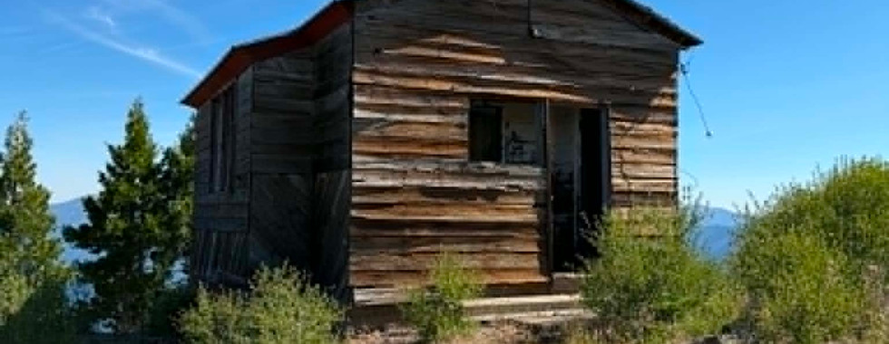
Eddie Gulch Fire Lookout
Blue Ridge Lookout
Forks of Salmon
Land Managers & Other Resources
Permits & Papers
n/a
Route Details
The Klamath Mountains of Northern California are one of the most geologically complex and botanically diverse regions in the American West. Unlike the volcanically dominated Cascades to the north or the granitic Sierra Nevada to the east, the Klamaths are an ancient and chaotic jumble of terranes, each with its own origin story. Peridotite, serpentinite, and other ultramafic rocks create soils so chemically hostile that specialized plant communities have evolved to survive them, which is why botanists have long considered this region one of the most significant biodiversity hotspots in North America. Layer on top of that a rich and complicated history of gold mining, homesteading, and indigenous culture, and you have the raw ingredients for one of the finest overland routes in the state.
The Trinity Alps Backcountry Discovery Trail connects the upper Sacramento River drainage in the east to the Forks of Salmon in the west, threading through the heart of the Klamath and Trinity mountain ranges along the way. It passes Trinity Lake, Coffee Creek, the Russian Wilderness, and comes within striking distance of the Marble Mountain Wilderness before dropping into the deep canyon country of the Salmon River. For the sake of this guide we move east to west, though the route works equally well in reverse.
The route kicks off near the Sacramento River (DP) and wastes no time getting into the mountains. Dog Creek Road climbs steeply off the valley floor into a dense conifer forest, the kind of dark, quiet forest that reminds you why people fall in love with Northern California. The dirt here is mellow and well-graded, the kind of road that lets you settle in and start paying attention to your surroundings. Eventually the trees give way to views and the road drops you down to Trinity Lake, where a short stretch of pavement winds along the northern fingers of the reservoir. The East Fork Trinity River (DP) runs through this stretch and offers some excellent dispersed camping for those looking to spend the first night close to the water.
From the lake the route begins climbing again, this time headed for Bonanza King Lookout (DP), and this climb is worth every bit of effort it takes to get there. The road works its way up to a fire lookout perched at the top of the mountain, and the views from up here are among the best on the entire route. On a clear spring day when the high peaks of the Trinity Alps are still plastered with snow, this is easily one of the best views in the North State (far Northern California). The mountain takes its name from a rich gold mine that once operated along its western slopes, part of a broader swath of mining activity that defined this corner of Northern California for decades. The descent is straightforward, nothing a stock 4x4 can't handle, and it drops you back down to the main fork of the Trinity River.
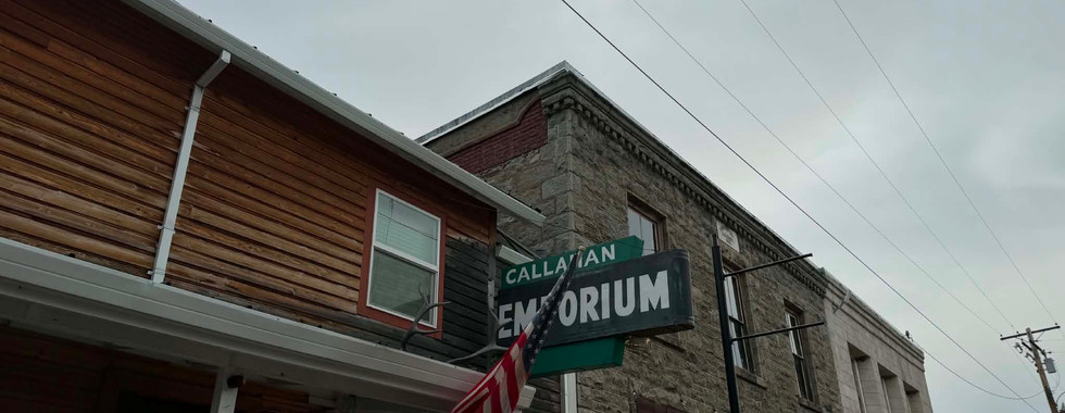
Down on the river, stop in at the Historic Carville Inn (DP), an old stagecoach stop that once served travelers making their way through this remote country. Nearby, the old tailings and bucket line dredge marker (DP) tells the story of the area's gold mining past. The pits and tailings piles still visible here are remnants of an industry that once made this part of California famous as part of the Northern Gold Fields. It's industrial history on a massive scale, and it's still written all over the landscape.
The next stretch involves an out-and-back up Coffee Creek, pushing deep into the heart of the Trinity Alps (DP). This drainage suffered a significant fire in recent years and is still working its way back, but even in recovery there's beauty here, and the road follows the creek toward the headwaters of the Salmon River, eventually dead-ending at the wilderness boundary. Numerous trailheads along the way provide access into the Trinity Alps Wilderness for those who want to get out and stretch their legs. Retrace your tracks back to Highway 3 and rejoin the pavement briefly before turning onto Ramshorn Road.
Ramshorn Road has a devoted following among the ADV motorcycle crowd, and it's easy to see why. The road climbs up and over the mountain before dropping into the headwaters of the East Fork Trinity River through some gorgeous mountain terrain, with long views and a real sense of getting off the beaten path. Near the bottom, a spur road leads to Tamarack Lake (DP), which is the one section of the route that earns a moderate technical rating. The trail has rocks, it requires a little more attention, but the payoff is one of the prettiest alpine lakes you'll find anywhere in the Klamaths. If you've got the time the lake has a fantastic campsite right on the lake. Tracing your tracks back to the main route, Panther Rock Road takes you up and over and puts you back on pavement. If Tamarack didn't work out for camping, Gumboot Lake is a popular option nearby, and Cliff Lake is another out-and-back of similar character (moderate trail) to Tamarack if you're still looking for that secluded alpine feel.
Just past Gumboot Lake the dirt resumes and the route enters one of its most scenic stretches, rolling through high mountain terrain directly below Mt. Eddy (DP), the highest point in the entire Klamath Mountain range. The road passes just below Deadfall Meadows (DP) before eventually returning to pavement. If you have half a day to spare, the hike up to Deadfall Lakes is one of the better ones in the region and well worth the boot time.
Back on pavement, a short out-and-back leads to the top of Scott Mountain (DP). The geology up here is striking. The reddish ultramafic rocks, primarily peridotite, are characteristic of the Klamath and Siskiyou Mountains and give the summit a color and texture unlike anything you'll find in the neighboring ranges. The views are excellent and reaching the true summit requires a short scramble on foot. It's worth it. Drop back down to Highway 3, follow the pavement to the Scott Mountain Campground at the summit, then peel off onto dirt again for the backway approach to Kangaroo Lake (DP). This section involves some narrower secondary roads and a few shelf road stretches, but the destination delivers. Kangaroo Lake sits in a steep-walled cirque and ranks alongside Tamarack as one of the gem lakes of the Klamath Mountains. Back on pavement at the lake.
The longest paved section of the route follows, roughly 35 miles when you factor in the out-and-back into Etna. The town is a classic small mountain outpost, the kind of place where you can top off the tank, grab a meal, and actually have a conversation with someone who knows the country. Worth the detour. Back on route, the road briefly follows the Scott River (DP) before climbing back into the mountains and beginning the circumnavigation of the Russian Wilderness (DP). This is wild, quiet, lesser-visited country. The Russian Wilderness doesn't get the same attention as the Trinity Alps or the Marble Mountain Wilderness, but it's just as beautiful, a compact and rugged landscape of pine and fir forest wrapped around a tight cluster of alpine peaks. Out here you feel genuinely remote.
The final stretch of the route moves through high mountain terrain passing Eddie Lookout (DP) and Blue Ridge Lookout (DP) before making the long drop down to Forks of Salmon (DP). The canyon country deepens as you descend, the walls closing in and the Salmon River growing louder. The route officially concludes at Nordheimer Campground, a fine place to end the journey and a popular summer base for those exploring the Salmon River country. The surrounding area is steeped in mining history. Old camps like Sawyers Bar, Cecilville, and Orleans are scattered through these mountains, reminders that long before overlanders came through here, prospectors were working every creek and canyon in search of gold. Some things don't change. The country is still just as hard to get to, and just as worth the effort.
Terms of Use: Should you decide to travel a route that is published on Overlandtrailguides.com, you do so at your own risk. Always take the appropriate precautions when planning and traveling, including checking the current local weather, permit requirements, trail/road conditions, and land/road closures. While traveling, obey all public and private land use restrictions and rules, and carry the appropriate safety, recovery, and navigational equipment. The information found on this site is simply a planning resource to be used as a point of inspiration in conjunction with your own due-diligence. In spite of the fact that this route, associated GPS track (GPX and maps), and all route guidelines were prepared under diligent research by OverlandTrailGuides.com, the route accuracy and current conditions of roads and trails cannot be guaranteed.