
Mammoth Backcountry Discovery Trail
- OTG Crew
- May 7
- 10 min read
Updated: Jun 3
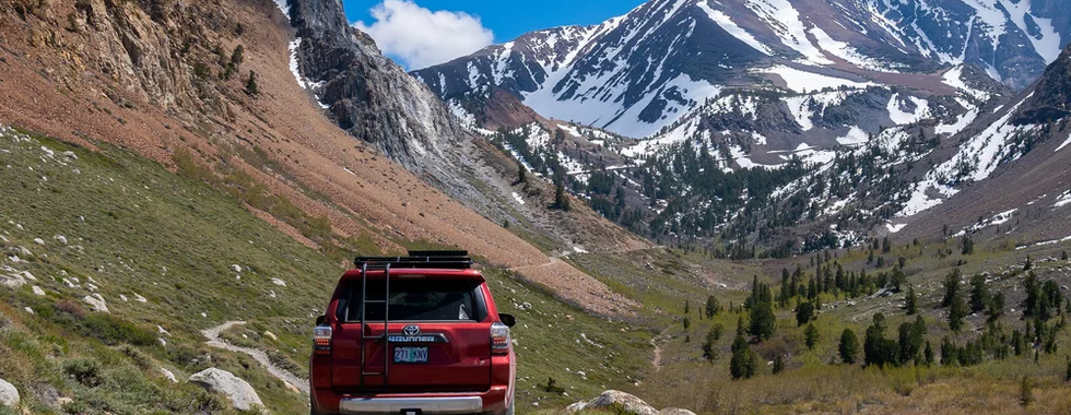
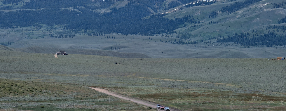
The Mammoth Backcountry Discovery Trail traces a 360 mile loop through the volcanic heart of the Eastern Sierra, connecting a landscape that few overlanders have explored in its entirety. Ancient calderas, obsidian domes, alpine ghost towns, and the highest drivable ridgelines in California are all on the table here, cycling through pumice flats, Great Basin sagebrush, and high alpine terrain before dropping back into the shadow of the Sierra Nevada. This is a route where geology does the heavy lifting and history fills in the gaps. The Mammoth BDT rewards the traveler who comes curious and unhurried.


Route Overview
Trip Length & Season
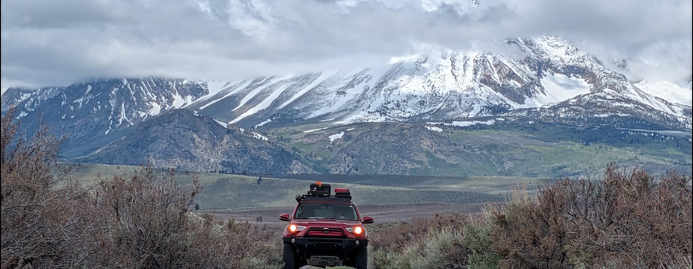
Adventure Rating: Epic Trip Length: 360 mi, 5-8 days Season: The sweet spot for travel is mid-June through early October, though in low-snow years many trails open by May and remain accessible into November. Always check conditions before heading out, particularly snowpack at the higher elevations.
Digital Maps & GPX Files
Download Digital Mapping Files
If you need help working with digital mapping and GPX files, please check out our FAQ section.

Technical Ratings & Terrain
Avg Technical Rating: 2-3
Peak Technical Rating: 4
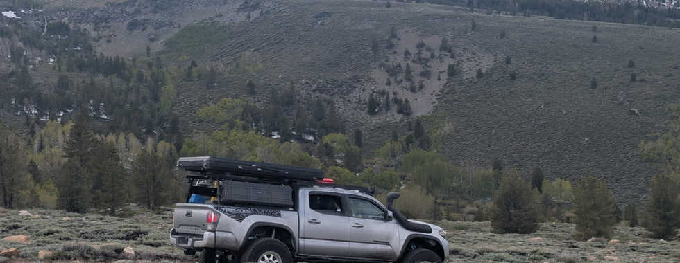
Typical Terrain: The majority of this track is dirt, consisting of a mixture of pumice and sand two-track, graded dirt roads, and open sagebrush basin driving, with a handful of narrower shelf roads, rocky descents, and loose alpine terrain at the higher elevations. Expect numerous bumps, ruts, and roots as you make your way through the volcanic trails around Mammoth Lakes along with steep eroded trails as you make your way over the Sweetwater Range. There are some sections of interconnecting pavement.
Recommended Vehicle / Moto / Adventure Vans
Recommended Vehicle: Stock 4x4
Recommended Moto: A mid-weight bike or dual-sport is recommended given some of the sandy, steep, and rocky terrain.
Adventure Vans: Sprinters and Transits are not recommended.
Fuel, Provisions, and Recommended Gear
Fuel: Fuel is readily available along most of the route, with a few longer gaps noted below.
From fuel in Lake Crowley to Mammoth Lakes is 50 mi
Mammoth Lakes to Lee Vining is 45 mi
Lee Vining to Bridgeport is 65 mi
Lee Vining to Lake Crowley is 210 mi (end of route) If 210 mi is beyond your range, consider taking Aurora Canyon Road down the montain before reaching Bodie State park, this is 70 mi from Bridgeport to Bridgeport, and then it's 140 mi from Bridgeport back to Lake Crowley
Provisions: Provisions can be obtained in the same general vicinity as fuel. Gear: n/a
Alternative Routes
Sweetwater Snow Bypass
Distance: 26 miles
Technical Rating: 3 The track up and over Mt. Patterson and Mt. Wheeler ranks among the highest elevation drivable trails in California. If the crossing over the mountains is impassable due to snow, the Sweetwater Snow Bypass offers a thrilling and scenic alternative around the high peaks of the Sweetwater Range. Much of this route follows bumpy two-track, but the payoff is hard to argue with as you traverse a series of open ridges with sweeping views in every direction. Casa Diablo Track
Distance: 5 miles
Technical Rating: 4 If you're looking for the scenic route around Casa Diablo Mountain, this is it! Expect tight two track with plenty of rocks through the juniper and pinyon pine. The route includes a number of interesting rock outcroppings and other geological features along the way.
Camping Recommendations
The Mammoth BDT features an incredible amount of dispersed camping options. One note, despite what you may see/read, camping along the shore of Lake Crowley is generally prohibted as this is LA Water District Land, which prohibits overnight camping. Generally, dispersed camping is allowed on nearly all national forest and BLM land along this route. Some of our favorite places to camp include:
Hot Creek
Bishop Tuff Loop
Owen Gorge vicinity
Marmot Camp (Green Creek)
June Lake Viewpoint
Benton Crossing (can get busy)
Mono Craters vicinity
Lobdell Lake
East Walker River Recreation Area (fee)
Sagehen Meadows Campground (or surrounding area)
Discovery Points
Bishop Tuff Scenic Loop
Owens Gorge
Lake Crowley
Owens River
Wild Willy's Hot Springs
Hot Creek Geological Site
Long Valley Caldera
Inyo Craters
Deadman Dome
Obsidian Dome
June Lake
Mono Craters
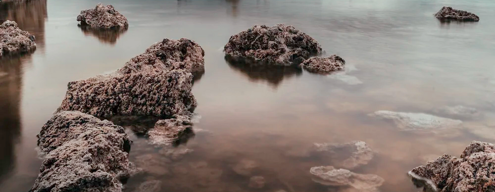
South Tufa Area
Mono Lake
Mono Basin Visitor Center
Log Cabin Mine
Jordan Spring Road
Kavanaugh Ridge
Travertine Hot Spring
Bridgeport
Mono County Museum
Montague Mine stone cabin
Mount Patterson
Mars with Flowers
Belfort
East Fork Walker River
Walk River State Recreation Area
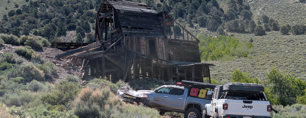
Chemung Mine
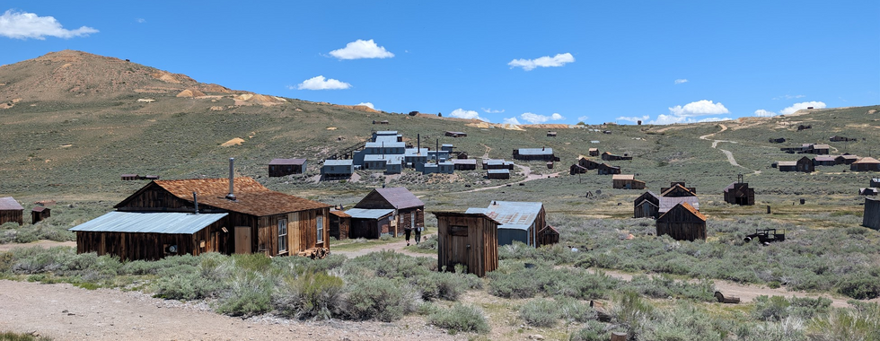
Bodie Ghost Town
Crooked Meadows
Glass Mountain
Casa Diabla Mine
Chalk Bluff
Land Managers & Other Resources
Permits & Papers
Bodie State Historic Park
There is a modest day use fee if you plan to visit Bodie State Historic Park, which is one of the highlights of the route. Please visit the Bodie State Historic Park website for fee information.
Route Details
The Mammoth Backcountry Discovery Trail is a 300 plus mile loop through one of the most geologically active and historically rich corners of California. From the volcanic domes and pumice flats north of Mammoth Lakes to the ghost towns and alpine heights of the Sweetwater Mountains, this route covers serious ground across dramatically varied terrain. Expect two-track pumice and sandy roads, shelf roads through dense pine forest, wide open sagebrush basin driving, creek crossings, steep alpine descents with loose and rocky sections, and some of the highest drivable ridgelines in the state. The route is described here in a clockwise direction beginning at Sherman Summit on Highway 395, though it can be run in either direction.
The adventure begins at Sherman Summit, where the pavement ends and the Bishop Tuff Scenic Loop (DP) begins. Two-track trails cross open pumice flats through sagebrush and scattered pine forest, with volcanic rock outcroppings appearing throughout. The route wraps up this stretch with a short section of pavement along Owens Gorge (DP), well worth a stop for the views down into the canyon.
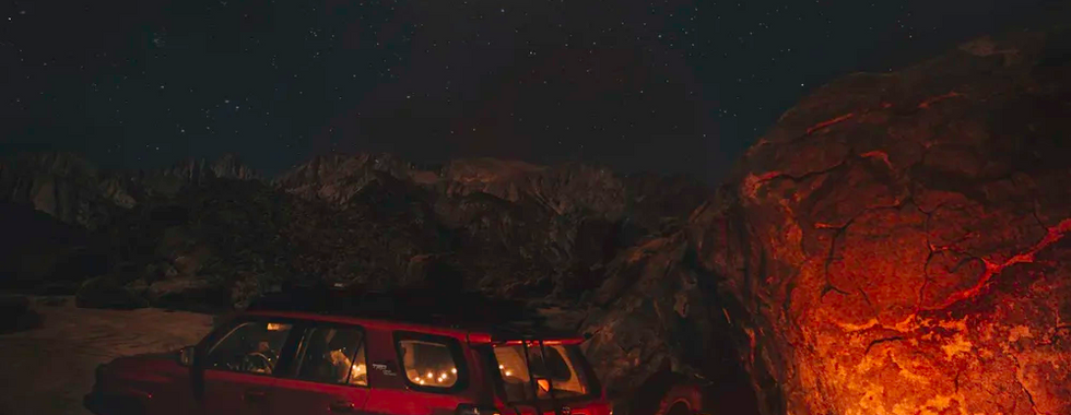
Cross the Long Valley Dam and follow the Owens River north before tracing the east side of Lake Crowley (DP). This is one of the better camping stretches on the loop, with dispersed spots available at lake level and on the benches above. The dirt road along the lake has deep pumice sections that behave almost like sand, along with some washboard and pocked surfaces. Nothing a capable rig can't manage, but expect some chop. At the north end of the lake, a brief run on Benton Crossing Road (DP) transitions to Owens River Road, which crosses Hot Creek (DP). The Hot Creek Geological Site, about 1.5 miles south via Hot Creek Hatchery Road, is a must-see stop where active geothermal forces have produced steaming vents and boiling pools along the creek. If a soak is more appealing, Whitmore Tubs Road leads west to Wild Willy's (DP) and a cluster of popular hot springs spread across the basin floor. From Hot Creek, the route crosses the floor of the Long Valley Caldera (DP), a massive volcanic depression formed roughly 760,000 years ago in one of the largest eruptions in North American history. The caldera sits at a geological crossroads between the Sierra Nevada to the west and the Basin and Range province to the east, and its geothermal activity continues today. Mammoth Mountain itself is a resurgent lava dome within its massive caldera system.
After crossing Highway 395 near the Mammoth Lakes junction, the forest thickens considerably and the route enters a corridor of volcanic landforms north of town. A side trip to Inyo Craters (DP) is worth the detour, where a short hike leads into a series of phreatic explosion craters set in a quiet pumice clearing. Back on the main route, the road passes directly alongside Deadman Dome (DP) before reaching Obsidian Dome (DP), one of the most striking features on the loop. The dome's surface is fractured volcanic glass, jet black and razor-edged. A hiking trail through the dome is highly recommended for those who want to get up close. Roads in this area are narrower with some shelf road sections, winding through dense forest and pumice terrain.
The route wraps around Obsidian Dome via 2S10, also known as Hartley Springs Road, an accessible pumice two-track that skirts the north flank of Mt. Downs. Catch the June Lake Viewpoint (DP) before dropping back to Highway 395. Crossing the highway, the landscape opens into broad sagebrush basin country along the base of the Mono Craters chain (DP). The road passes Panum Crater, the youngest of the chain at roughly 650 years old, with an accessible rim trail and a well-preserved plug dome rising from its center. Continue north to Test Station Road, where a short and highly recommended sidetrip leads to the South Tufa Area (DP) on the shore of Mono Lake. A short walk along the South Tufa Interpretive Trail puts you among the ancient calcium carbonate tufa towers the lake is famous for. A mostly graded dirt road then traces the lakeshore to Highway 395, but rather than head north, you'll make a quick trip through Lee Vining and up the mountain.
Passing through Lee Vining, the route heads up to Log Cabin Mine (DP) on an out-and-back spur, 5.5 miles each way on a rocky and narrow road rated moderate. The mine sits at roughly 9,000 feet above the Mono Basin and operated through the 1930s as a sophisticated gold operation for its time, employing heavy milling machinery and an aerial tramway to process ore from rich quartz veins high on the ridge. It was shut down in 1942 by wartime federal order and never reopened. The multi-story mill building, blacksmith shop, warehouse, miner's cabins, and remnant tramway towers are all still standing, kept intact by the dry high-altitude air and the site's isolation above the basin floor. Head back down the mountain and to the highway, where the route heads north approximately 10 miles to Conway Summit.
From Conway Summit, leave the pavement and pick up Jordan Spring Road for a loop around Copper Mountain (DP). This is predominantly easy two-track with a few moderate sections, and the views of the surrounding ranges and Mono Lake below are among the best on the route. The loop drops back to pavement briefly on Virginia Lakes Road before climbing to Kavanaugh Ridge (DP), a scenic high-country two-track cresting near 11,000 feet with exceptional views of the Sierra crest. The route descends via Dunderberg Mill Road before returning to Highway 395 for the longest paved stretch of the loop, approximately 20 miles north.
From Highway 395, the route climbs into the Sweetwater Mountains, a quieter range straddling the California-Nevada border with a character distinct from the volcanic terrain around Mammoth. The climb passes Lobdell Lake before steepening above treeline into the open high country. Before the final push to the summit, look for the short offshoot to the Montague Mine Stone Cabin (DP), a remnant of the heavy mining activity that shaped this range. The Top of Mt. Patterson (DP), at just over 11,600 feet, is the highest point on the entire loop. The zone above treeline here is known locally as Mars with Flowers (DP), named for the small wildflowers that push up through the barren rocky terrain at altitude. An American flag marks the summit and the photographic opportunities in every direction are hard to beat. The descent wraps around Wheeler Peak and drops into Belfort (DP), an old mining camp where a weathered log cabin still stands. The trail down from Mt Patterson through Belfort and below is steep with loose and rocky sections in places, though nothing beyond moderate. The route meets pavement at Road 338.
A mile south on Road 338 leads to Masonic Mine Road, a well-graded dirt road climbing up and over Masonic Mountain (DP). Mining history is visible throughout the climb, with old workings and remnant structures scattered across the terrain. Before descending toward Bodie, make the sidetrip to Chemung Mine (DP), a gold and silver producing operation with several crumbling wooden structures still standing and a local reputation for being haunted. The descent off Masonic delivers you to Bodie State Historic Park (DP), one of the most well-preserved ghost towns in North America. At its peak in the late 1870s, Bodie was home to nearly 10,000 residents and over 2,000 buildings. Today, roughly 170 structures remain, maintained by the California Department of Parks in a state of "arrested decay," stabilized but not restored, aging honestly in the high desert wind. The graded sagebrush road approaching from Masonic has a distinctly Great Basin feel that makes for a fitting arrival.
From Bodie, a graded dirt and gravel road carries the route south through open sagebrush basin country before wrapping around the eastern shore of Mono Lake and connecting to a short paved section on Route 120 / Mono Mills Road. That pavement signals the final leg of the loop. The route climbs back into pine forest and pumice terrain on the flanks of Glass Mountain (DP), a large obsidian-rich volcanic dome that erupted roughly 100,000 years ago and remains one of the largest glass mountain formations in the world. Pass through Crooked Meadows (DP), an oddly shaped alpine clearing mid-mountain, and continue up through volcanic outcrops and cliff formations before the final descent. The southern flank of Glass Mountain drops steeply via a narrow, sandy fall-line trail with a few rocky sections along the way, rated moderate and requiring attention on the way down. Views on the descent are next level.
Once off the mountain, you're in the home stretch. Casa Diablo Road is a wide, sandy corridor rolling through open sagebrush basin with broad views in every direction, a relaxed finish after the intensity of Glass Mountain. For those looking to go out on a high note, an alternate route around Casa Diablo Mountain branches off the main road and delivers the most technically demanding trails on the entire loop, tight and rocky but still within moderate range. The loop closes out by passing through the Volcanic Tablelands, a broad expanse of ancient Bishop Tuff that bookends the route in fitting geological fashion. The same volcanic forces that shaped the pumice flats at Sherman Summit, the obsidian domes above Mammoth, and the caldera floor of Long Valley are written into these ancient tuff cliffs as well. Drop down to follow the Owens River corridor and trace Chalk Bluff (DP) back to Highway 395 — the Mammoth BDT is complete.
Terms of Use: Should you decide to travel a route that is published on Overlandtrailguides.com, you do so at your own risk. Always take the appropriate precautions when planning and traveling, including checking the current local weather, permit requirements, trail/road conditions, and land/road closures. While traveling, obey all public and private land use restrictions and rules, and carry the appropriate safety, recovery, and navigational equipment. The information found on this site is simply a planning resource to be used as a point of inspiration in conjunction with your own due-diligence. In spite of the fact that this route, associated GPS track (GPX and maps), and all route guidelines were prepared under diligent research by OverlandTrailGuides.com, the route accuracy and current conditions of roads and trails cannot be guaranteed.