
San Rafael Swell Adventure Route
- OTG Crew
- Apr 4, 2020
- 7 min read
Updated: Dec 22, 2025
40 million years ago a giant dome of rock was uplifted from the earth, creating the unique desert topography that is the San Rafael Swell. With its technical trails, stunning desert scenery, hikes to slot canyons and natural bridges, and rich aboriginal history, the San Rafael has it all.
Route Overview
Trip Length & Season
Adventure Rating: Epic Trip Length: 225 miles, 3.5-7 days Season: Year round, but best the best time to visit is spring or fall. Heavy snow may close some trails. Like many desert trails in the Southwest, it's best to avoid these trails during or immediately after heavy rainfall.
Digital Maps & GPX Files
Download Digital Mapping Files
If you need help working with digital mapping and GPX files, please check out our FAQ section.

Technical Ratings & Terrain
Avg Technical Rating: 2-3
Peak Technical Rating: 4
Typical Terrain: Graded dirt roads along with some moderate jeep trails that include rocks, ruts, and sandy washes (Eva Conover, Behind the Reef, Eagle Canyon). Behind the Reef has a significant amount of exposure on one section and may be narrow for full size trucks (passable as of spring 2025 though).
Recommended Vehicle / Moto / Adventure Vans
Recommended Vehicle: High clearance 4x4. Full Size trucks and vehicles with high roofs/campers will likely need to use the freeway access alternative route at the end of the trail due to the limited height of the tunnels that pass under the interstate to Sinbad's head.
Recommended Moto: Given the technical and rocky nature of the Swell, a mid-sized or dual sport bike is recommended.
Adventure Vans: Sprinter 4x4s are not recommended. But Ford Quigleys and Sportsmobiles. should be good to go. It may be a tight squeeze through the tunnel under I-70 near Sinbad's head. Vans will likely need to use the freeway access alternative route at the end of the trail due to the limited height of the tunnels that pass under the interstate to Sinbad's head.
Fuel, Provisions, and Recommended Gear
Fuel: Be prepared to travel 250+ miles if you do the entire route without refueling. It is possible to break away and refuel at multiple locations throughout the route, but this typically requires a 25+ mile round trip to obtain gas. Fuel can be located in Castledome (northern end of the Swell), Emery (take Moore Cutoff Road), Hanksville (south of the Swell), and Green River (East of Black Dragon Canyon). Provisions: Provisions can be obtained in the same general vicinity as fuel. Gear: no specialized gear is recommended for this adventure.
Alternative Routes
Devil's Racetrack Peak Trail Rating: 6
Those seeking a more technical option may consider bypassing Eva Conover Trail for the Devil's Racetrack, a favorite trail in the OHV and Jeep crowd. This trail is packed with rocks, and rock steps. A spotter is recommended, along with rock sliders, and a 2+ inch lift.
Freeway Access Trail Rating: 1
Full size vehicles with higher roofs are likely to tall to make it under the tunnel underpass that leads to Sinbad's Head at the very end of the route. Use the Freeway Access to reach the interstate. If you plan to do Devil's Racetrack, you'll likely need to make a big loop around the Swell to reach the trail.
Camping Recommendations
The Swell is loaded with hundreds of amazing dispersed camp sites. While dispersed camping is permitted throughout the majority of the Swell, please note that you must camp in a designated site within Buckhorn Wash and camping is not permitted with Black Dragon Canyon. Some of our favorite locations to camp include:
Buckhorn Wash
Along the San Rafael River on Mexican Mountain Road
The Wedge
Eva Conover Trail (sites tend to be small)
Eagle Canyon Arch
Circa Loan Warrior petroglyph
Behind the Reef vicinity
Chute Canyon Vicinity
North Template Mountain wash (can get busy)
Family Butte area
Tomsich Butte vicinity
Hidden Splendor
Block Mountain vicinity
Discovery Points
Petroglpyh Canyon Panel
Spirit Arch
Black Dragon Canyon petroglpyhs
Black Dragon Canyon
The Sinkhole
Old San Rafael Swinging Bridge
San Rafael River
Red Canyon
Split Rock
Buckhorn Wash
Buckhorn Wash petroglpyhs
Dinosaur Footprint
Wedge Overlook
Little Grand Canyon
The Drips
Eva Conover Trail
Eagle Canyon Overlook
Eagle Canyon Bridges
Eagle Canyon Trail
Eagle Canyon Arch
The Icebox
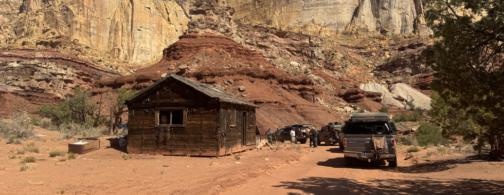
Swasey Cabin's
Loan Warrior Petroglyph
Reds Canyon
Tomsich Butte Uranium Mine
Hondu Arch
Hidden Splendor Overlook
Miner's Cabin
Behind the Reef Trail
Chute Canyon
Crack Canyon
Temple Wash Petroglpyhs
Wild Horse Window
North Temple Wash
Dutchman Arch
Head of Sinbad
Land Managers & Other Resources
Permits & Papers
n/a
Adventure Badge
OTG has partnered with All Roads Taken to offer an adventure badge for this route. >> Buy your adventure badge today!

Route Details
Covering an area of roughly 2,000 miles in central Utah, the San Rafael Swell is about a 90 minute drive from Moab. The swell consists of a giant dome of rock that was uplifted 40-60 million years ago. The sandstone, limestone, and shale rock that form the swell has eroded in the high desert to create a classic western landscape littered with buttes, mesas, gorges, badlands, and numerous natural arches. While Moab gets most of the attention in region of Utah (and with that attention comes large crowds), the San Rafael has much to offer in terms of terrain, history, and scenery. The numerous petroglyphs and pictographs on canyon and rock walls are visible reminders of the Paiute, Ute, and Fremont peoples who once called this area home, and a favorite of those who visit the Swell.
Your adventure begins at an unmarked dirt road on Interstate-70 (about 50 feet past mile marker 147 heading west), which is the beginning of Black Dragon Canyon. The gate is often closed to keep free ranging cattle off the interstate, so be sure to close it behind you (please close any gate that you need to open along the route). Black Dragon Canyon is a graded road that meanders through a magnificent canyon with vertical sandstone walls. Numerous petroglyphs can be found on the canyon's walls, including one that appears to be a dragon. The road snakes its way west, until it intersects with Buckhorn Draw Road. Buckhorn Draw Road is another wide and graded road. This portion of the route passes by many low elevation mesas and buttes as the road heads north towards the San Rafael River. Once you reach the river, be sure to check out the swinging suspension bridge that the Civilian Conservation Corps built in 1937 (you can still walk across it). Once you cross the bridge, swing a right onto Mexican Mountain Road/San Rafael River Road, another graded dirt road. As you make your way down the road, the the rock on the cliffs begins to change to a rusty red that the southwest is renowned for. The end of Mexican Mountain Road is now blockaded, making this leg of the journey purely a sightseeing side trip. Unless you decide to make camp for the night, turn around and head back towards the direction you came.
Once you arrive at the San Rafael River bridge, stay right and continue on Buckhorn Draw Road. This portion of Buckhorn Draw makes its way through a rather picturesque canyon, gradually gaining elevation. Notice the change in flora-- pinyon pine and juniper woodland dominate the landscape. This sloped mesa is simply known as the Wedge, and contains some of the best viewpoints overlooking the swell and some fantastic campsites if you're lucky enough to snag one (but be mindful of the wind at night!). Head to the Wedge overlook to check out the little Grand Canyon. From the Wedge, the next trail on the agenda is Fuller Bottom Road, a well maintained county dirt road with excelled views of the desert plans and surrounding mesas. Once you cross the San Rafael River, stay left onto Dutch Flat Road, which is another relatively mild dirt road. Dutch Flat brings you to the top of coal wash, which is where the fun begins. Eva Conover is a blue trail with numerous rocks, and some of the best views in the swell as it snakes its way through a wash that gradually turns into a canyon. If you've been paying attention to your map, you'll notice that your approach I-70. Eagle Canyon trail goes directly under the interstate, providing a magnificent view of the engineering feat that is the Eagle Canyon Bridges. Like Eva Conover, this trail has its fair share of rocks and there is one section that is a tight squeeze for full size rigs. Soon enough you'll be trading the rocks for the graded dirt road of Reds Canyon. While the road may be mild mannered, the surrounding buttes, cliffs and rock formations make for fantastic scenery, especially during dawn and dusk. If you're looking for a place to set up camp, Reds Canyon and McKay Flat Road provide dozens of primitive camp locations. As you leave the graded dirt of McKay Flat behind, you'll traverse one of the more technical sections of the route, Behind the Reef Trail. Behind the Reef is a slow-going technical and rocky trail, with steeps, narrows, exposure, and numerous tight sections. Chute Canyon and Crack Canyon are awe inspiring slots canyons that are worthy of side adventures. While Chute and Crack Canyons are both awesome in their own rite, if you only had one geological site to visit on this trip, it would have to be Wild Horse Window, a dazzling window and natural bridge (requires a 2.8 mile hike). Heading down Temple Mountain Wash, the route loops around to North Temple Wash, which provides a really cool driving experience as the wash close in to the width of the road.
As you head north back towards the interstate, the route wraps around Template mountain, and it's numerous abandoned mines. Making your way back north on the well maintained Template Mountain road. Once you reach the interstate, go through the tunnel to reach Sinbad's head (pictograph) and your final point of interest, Dutchman arch.
Gallery


Terms of Use: Should you decide to travel a route that is published on Overlandtrailguides.com, you do so at your own risk. Always take the appropriate precautions when planning and traveling, including checking the current local weather, permit requirements, trail/road conditions, and land/road closures. While traveling, obey all public and private land use restrictions and rules, and carry the appropriate safety, recovery, and navigational equipment. The information found on this site is simply a planning resource to be used as a point of inspiration in conjunction with your own due-diligence. In spite of the fact that this route, associated GPS track (GPX and maps), and all route guidelines were prepared under diligent research by Overland Trail Guides, the route accuracy and current conditions of roads and trails cannot be guaranteed.