
Arizona Overland Adventure Trail
- OTG Crew

- Mar 30, 2025
- 8 min read
Updated: Dec 27, 2025
Arizona is more than just desert and saguaro cacti—it's a land of striking contrasts. The 500+ mile Arizona Overland Adventure Trail captures this grandeur, winding through pine-clad mountains, scenic lakes, towering canyons, volcanic cinder fields, and snow-capped peaks. This might just be the ultimate overland route in Arizona.


Route Contributor

Originally known as the Heart of Arizona, this route was first developed by Journey West and later refined by the Arizona Pinstripers through extensive runs. After reviewing the route with Arizona Pinstripers founding member Dragos M., it was clear—this had to be part of OTG's route directory! This route isn't just a trail; it's a journey through some of Arizona’s most rugged and scenic terrain, shaped by those who know it best.
Route Overview
Trip Length & Season
Adventure Rating: Epic Trip Length: 557 miles, 6-12 days Season: The shoulder seasons of spring and fall typically provide the best weather (season typically opens mid-March and closes the end of November). It is possible to travel the route during the summer months, but expect 100F + heat around the lowlands around Phoenix (temps should be much cooler at elevation). The higher elevations portions of the route typically become impassable during winter due to snow, but may be open some years.
Digital Maps & GPX Files
Download Digital Mapping Files
If you need help working with digital mapping and GPX files, please check out our FAQ section.

Technical Ratings & Terrain
Avg Technical Rating: 2-3
Peak Technical Rating: 4
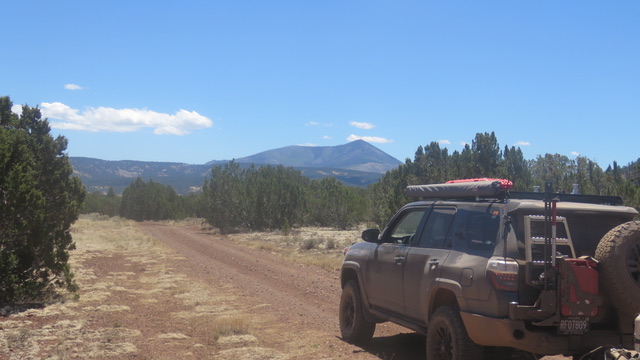
Typical Terrain: Expect a wide variety of terrain ranging from wide graded dirt roads, narrower and steeper secondary roads, sandy washes, trails that travel through pumice and cinder, and some rockier sections as well.
Recommended Vehicle / Moto / Adventure Vans
Recommended Vehicle: Stock 4x4
Recommended Moto: A mid-weight or dual sport bike is recommended given some of the moderate terrain.
Adventure Vans: Sprinters and Transit vans are not recommended on this route.
Fuel, Provisions, and Recommended Gear
Fuel: From the start of the route to Camp Vede is 100 mi, from Camp Vedera to Jerome/Clarkdale is 55 mi, from Clarkdale to Williams is 75 mi, from Williams to Winona is 115 mi, Winona to Heber (near Mogollon Rim) is 130 mi, from Heber to the end of the route (fuel in Fountain Hills) is 145 mi. Provisions: Provisions can be obtained in the same general vicinity as fuel. Gear: no specialized gear is recommended for this adventure.
Alternative Routes
Martin Canyon Trail
Distance: 18 miles
Technical Rating: 5
Smiley Rock is a fantastic option for folks looking to kick things up a notch. Expect lots of rocks as you make your way around Woodchute Mountain.
Road 354 Bypass
Distance: 25 miles
Technical Rating: 1
Road 354 that ascends from Perkinsville up to the plateau above Sedona and is a notoriously rocky trail that is prone to washouts. Full sized rigs and especially oversized rigs (like Earth Cruisers) and adventure vans (Sprinters and Transits) should consider taking this bypass. In fact, you can expect this to be the slowest going section of the trail.
Lone Pine Divide
Distance: 61 miles
Technical Rating: 3
The Lone Pine Divide provides an alterantite route for the more well travelled route that passes by McFadden Peak. Most of the track is well graded, but expect some rockier sections along the way.
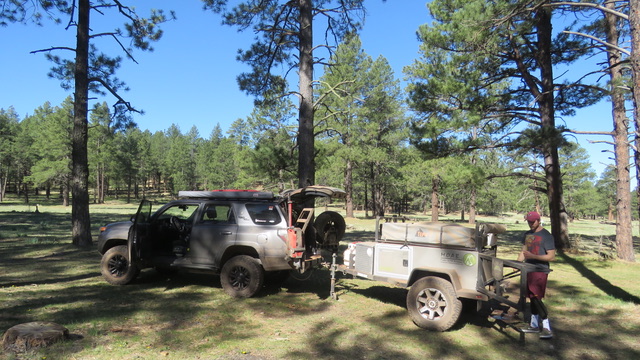
Camping Recommendations
With the vast amount of terrain this route covers, there are hundreds of dispersed camping opportunities over the 500+ miles. And while dispersed camping is generally permitted on National Forest and BLM land, just remember that you will need a permit to camp on Arizona State Trust Land. Below is a list of some of our favorite places to camp along the route.
Mingus Mountain campground
Sycamore Point vicinity (camping prohibited as the point)
Sunflower Flat vicinity
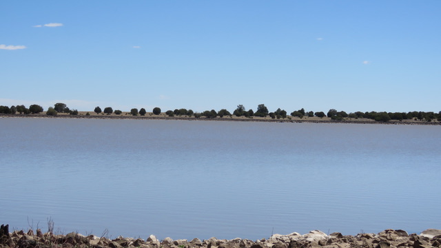
White Horse Lake campground
Cinder Cone Fields near Sunset Crater
Ashurst Lake campground
Kinnikinick Lake campground
Long Lake campground
Soldier Lake
Bear Canyon Lake campground
Mogollon Rim / Promontory Butte vicinity
Discovery Points
Verde River
Camp Creek Wash
Humboldt Mountain FAA Facility
Pueblo La Plata Interpretive Site
Sycamore Cabin
Mingus Mountain viewpoint
Mingus Mountain fire lookout
Jerome
Jerome State Historical Park
United Verde Mine
Perkinsville Bridge
JD Dam Wildlife Area
Sycamore Point
White Horse Lake
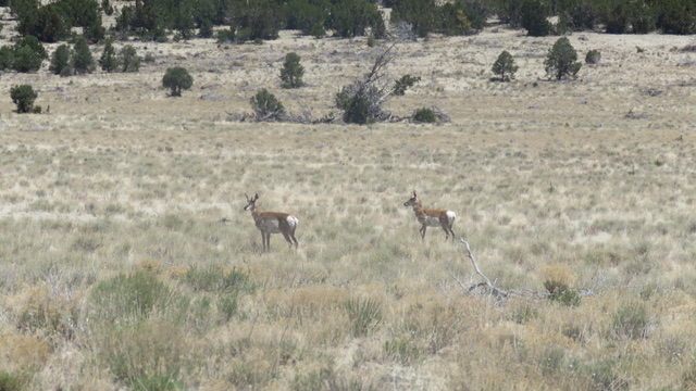
Sunflower Flat wildlife area
Sycamore Falls
Sitgreaves Mountain
Kendrick Peak
Tub Ranch lava flow
Humphreys Peak
Strawberry Crater lava flow
Cinder Hills overlook
San Francisco volcanic field
Long Lake
Moqui Lookout
Mogollon Rim
Woods Canyon Lake
Mogollon Rim Visitor Center
McFadden Peak fire lookout
Theodore Roosevelt Lake
Four Peaks
Land Managers & Other Resources
Land Managers
Other Resources
Permits & Papers
Permits
If you plan to camp on Arizona State Trust Land you'll need a permit.
Adventure Badge
OTG has partnered with All Roads Taken to offer an adventure badge for this route.

Route Details
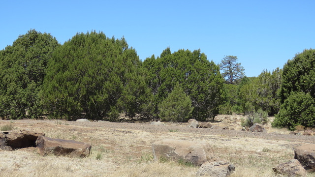
Arizona, the Grand Canyon State—famous for its red rock canyons, mesas, and the saguaro forests that blanket the southern half of the state. While the red rock country of Sedona and the Grand Canyon is incredible, Arizona boasts varied topography and an impressive range of ecosystems and biological diversity. The Arizona Overland Adventure Trail was developed by a small group of locals intent on showcasing Arizona in all its splendor—from the towering pines surrounding Flagstaff, the expansive volcanic fields near Williams, the grand 200-mile-long escarpment known as the Mogollon Rim, to the striking mountains like the Four Peaks Wilderness near Phoenix. There’s a lot to see in Arizona, and the Arizona Overland Adventure Trail hits it out of the park with the wide variety of terrain and scenery the intrepid traveler will experience.
While the route can be driven in either direction, this guide follows the loop in a clockwise direction starting just outside of Scottsdale. The track begins with a foray into the rugged beauty of Camp Creek Wash. Continuing north, the trail begins to climb into the mountains via Cave Creek Road. The desert scenery that dominates the Phoenix area gradually transitions into shrubland and woodlands. As you turn left onto Bloody Basin Road, pay attention to the views—they’re incredible. Soon you’ll find yourself traveling through juniper woodlands, similar to those around Sedona and Williams.
As you pass near the Agua Fria National Monument, consider stopping at the Pueblo La Plata Interpretive Site (discovery point). Pueblo La Plata is a significant archaeological site featuring the remnants of a large Pueblo village. Archaeologists believe the structure once contained 80 to 90 rooms, built using fieldstone and simple mud mortar.
Up until this point, the route consists primarily of mild, graded dirt roads. As you head north from the monument, expect one of the bumpier/rockier sections along the route. The trail includes portions impacted by erosion with ruts and a fair number of rocks—nothing typically considered technical by any means. If it’s vacant, Sycamore Cabin (discovery point) is worth a quick stop. Not far from the cabin, the route passes through Camp Verde—a great place to refuel before crossing the interstate.
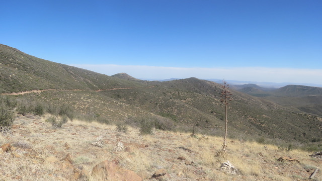
The trail then zigzags through rugged mountain slopes, climbing toward Mingus Mountain (discovery point). Expect a few spicier sections here, especially on the slopes above Jerome. The views atop Mingus are impressive, with Sedona’s red rock cliffs and mesas creating a stunning backdrop. Just down the mountain lies the historic mining town of Jerome (discovery point). Once called the “Wickedest Town in the West,” Jerome boomed in the late 19th and early 20th centuries thanks to its rich copper deposits. Today, it’s a haven for artists and tourists, with many renovated buildings and quaint shops.
From Jerome, the route climbs into the highlands that cap the mesas and canyons north of Sedona. As you pass the small outpost of Perkinsville, road 354 begins climbing up the mountain. This is one of the most rugged (rocky, not technical!) and slow going stretches of the entire route that can take 2 hours to complete the 10 mile stretech of rock-strewn trail. Full size and oversized rigs, and definitely adventure vans (Sprints and Transits) may want to skip this section (see road 354 bypass) It's not unusual for this 11 mile section to take more than 2 hours to complete. Consider taking the pavement of County Road 73 to bypass this section.
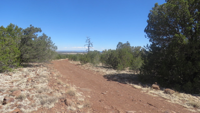
However, once you reach the mesa, you'll be blessed with one of the major highlights along the route, Sycamore Canyon. Sycacmore Canyon is one of Sedona's largest and least developed canyon. Most visitors to Sedona never make it to Sycamore Point (discovery point), an impressive overlook well worth the detour. The trail continues north on a series of mild dirt roads with opportunities to spot wildlife at JD Dam Wildlife Area (discovery point) and Sunflower Flat (discovery point).
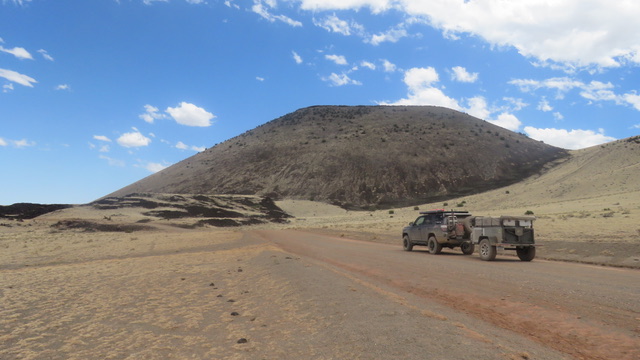
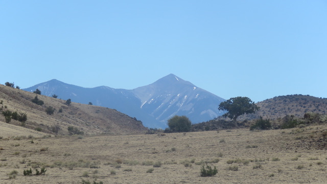
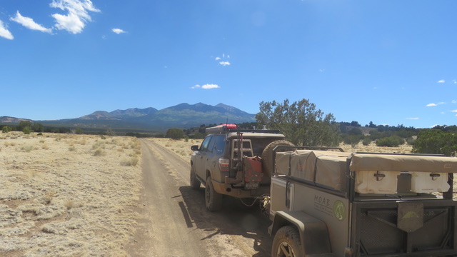
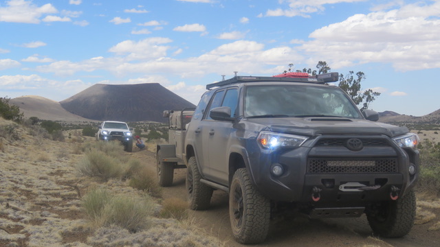
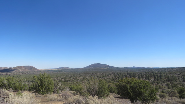
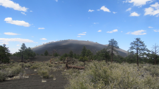
By now, you’ve probably glimpsed Arizona’s tallest mountain in the distance—Humphreys Peak (discovery point)—a sign you’re entering the massive San Francisco Volcanic Field (discovery point). Spanning 1,800 square miles across northern Arizona, the field features over 600 cinder cones, lava domes, and volcanoes. Pay attention to the three prominent volcanic peaks in the northern section of the route: Sitgreaves Mountain, Kendrick Peak, and Humphreys Peak (all discovery points). One of our favorite segments explores the cinder cone fields in and around Sunset Crater Volcano National Monument. The black and red cinders create a striking contrast against the green pine forests, and the area offers abundant dispersed camping opportunities.
By the time you’ve reached Sunset Crater, you’ve completed more than half of the Arizona Overland Adventure Trail. The route continues south on a series of graded dirt roads, with plenty of great lakeside camping options—Ashurst, Kinnikinick, Soldier, and Long Lakes among them. Moqui Lookout (discovery point) signals that you’re nearing the 200-mile-long escarpment known as the Mogollon Rim. It’s where many Arizonans flee to escape the summer heat—and the views are hard to beat. On weekends, Rim Road can be crowded with visitors and campers, but if you venture onto the smaller dirt roads nearby, you’ll likely find a fantastic campsite with a view to match.
Departing south from the Rim, you’re officially on the final leg of the route. You’ll follow a series of mostly graded dirt roads past McFadden Peak (discovery point), which eventually cuts westward above Theodore Roosevelt Lake (discovery point). The views from the ridge above the lake are second to none. The final stretch of the trail takes you through the rugged and incredibly scenic Four Peaks Wilderness (discovery point), a popular off-roading corridor for quick day trips. The Arizona Overland Adventure Trail officially concludes where the dirt meets the pavement at Beeline Highway.
Terms of Use: Should you decide to travel a route that is published on Overlandtrailguides.com, you do so at your own risk. Always take the appropriate precautions when planning and traveling, including checking the current local weather, permit requirements, trail/road conditions, and land/road closures. While traveling, obey all public and private land use restrictions and rules, and carry the appropriate safety, recovery, and navigational equipment. The information found on this site is simply a planning resource to be used as a point of inspiration in conjunction with your own due-diligence. In spite of the fact that this route, associated GPS track (GPX and maps), and all route guidelines were prepared under diligent research by OverlandTrailGuides.com, the route accuracy and current conditions of roads and trails cannot be guaranteed.


Comments