
Plumas Backcountry Discovery Trail
- OTG Crew

- Jan 16, 2020
- 5 min read
Updated: Jan 1
Unlike Lake Tahoe, and the central and southern Sierra, the northern Sierra is place to get away from the crowds and learn about California's rich cultural history. The hills and mountains of the northern Sierra were once filled with pioneers, miners, and prospectors hoping to strike it rich. While few of these early settlers found the riches they sought, the they did leave behind a rich history of historical relics and tall tales.


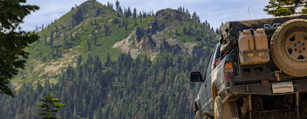


Most photos courtesy of Adventure Taco. Be sure to check out the Plumas BDT trip report from Adventure Taco.
Route Overview
Trip Length & Season
Adventure Rating: Epic
Trip Length: 167 miles, 2-4 days
Season: Recommended June - November (check with the Plumas NF for road conditions if its a heavy snowfall year).
Digital Maps & GPX Files
Download Digital Mapping Files
If you need help working with digital mapping and GPX files, please check out our FAQ section.

Technical Ratings & Terrain
Avg Technical Rating: 2
Peak Technical Rating: 4
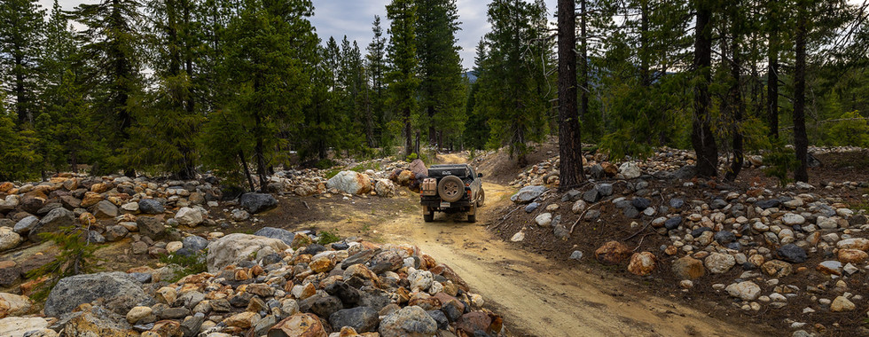
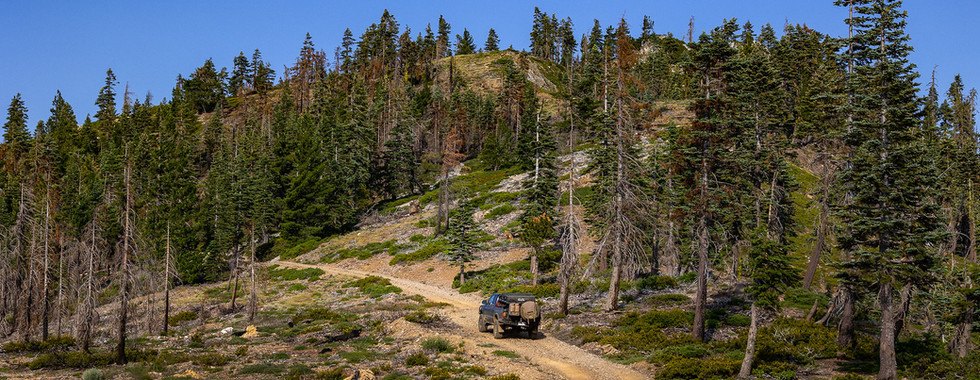
Typical Terrain: Primarily wide dirt forest service roads. The only truly moderate section is on Poker Flat, which has numerous off camber, steep, and rocky sections.
Recommended Vehicle / Moto / Adventure Vans
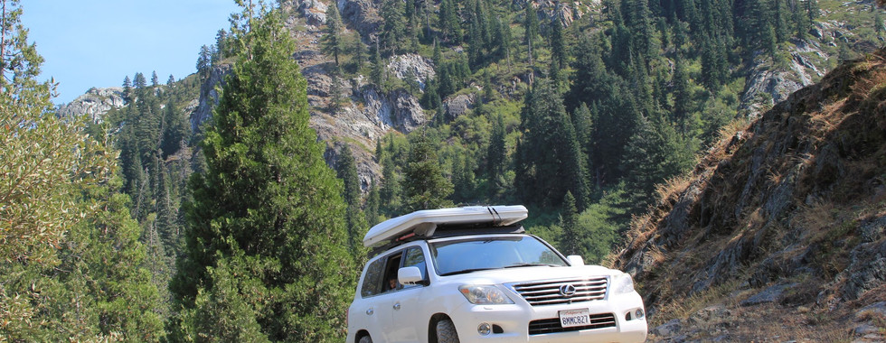
Recommended Vehicle: Stock 4x4
Recommended Moto: Unless you have a dual sport bike, skipping Poker Flat is advisable for big and mid-sized bikes. The rest of the route is suitable for adventure bikes of all sizes. The creek crossing can be tricking given the numerous large boulders and water than can run 12-24" deep.
Adventure Vans: Sprinter and Transit vans (4x4/AWD) should skip the beginning section along Poker Flat. The rest of the route is suitable for adventure vans.
Fuel, Provisions, and Recommended Gear
Fuel:
Camptonville to La Porte (40 mi)
La Porte to Quincy (75)
Quincy to Chester (85 mi)
Provisions: Provisions can be obtained in the same general vicinity as fuel. Gear: no specialized gear is recommended for this adventure.
Alternative Routes
n/a
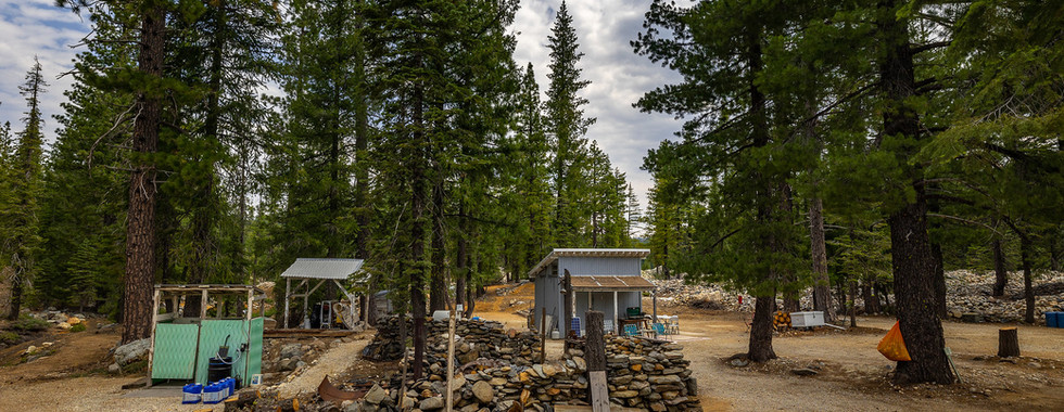
Camping Recommendations
Dispersed camping is permitted throughout the Plumas National Forest. While there are numerous campgrounds along the route, the surrounding forest and mountains are filled with loads of great camping spots.
Poker Flat
Little Beaver Campground
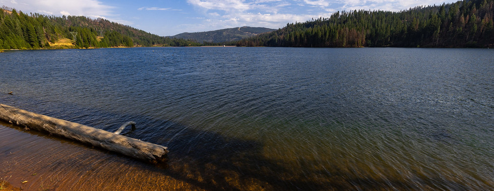
Pilot Lake
Meadowplace Campground
Hallsted Campground
Cool Spring Camp
Discovery Points
Poker Flat
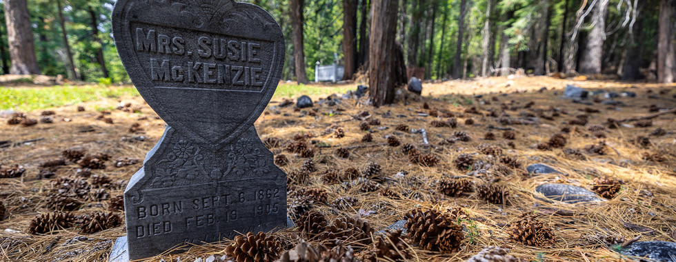
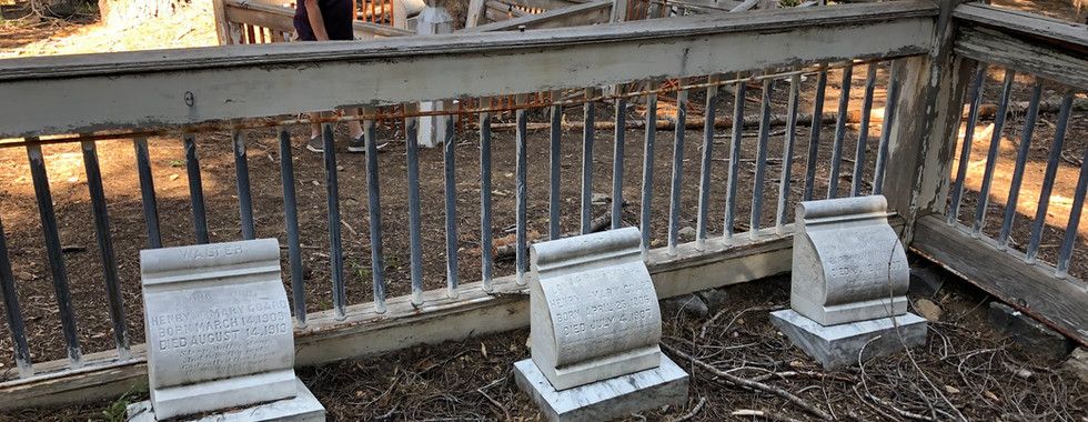
Howland Flat Cemetery
St. Louis Cemetery
St. Louis Bridge
Gibsonville Cemetery
Onion Valley Waming Hut
Pacific Crest Trail
Columnar Rock
Nelson Creek
Vista Point
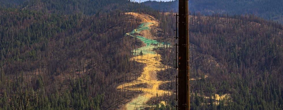
Cold fire
Middle Fork Feather river
Little Volcano
Foundation viewpoint
Claremont Peak
Sugar Pine Stand
Serpentine Rock Outcrop
Record Ponderosa Pine
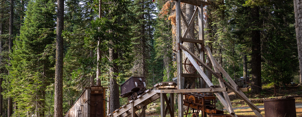
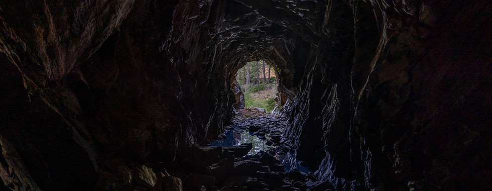
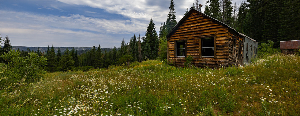
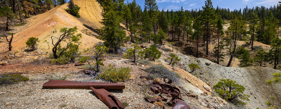
Spanish Creek Mines
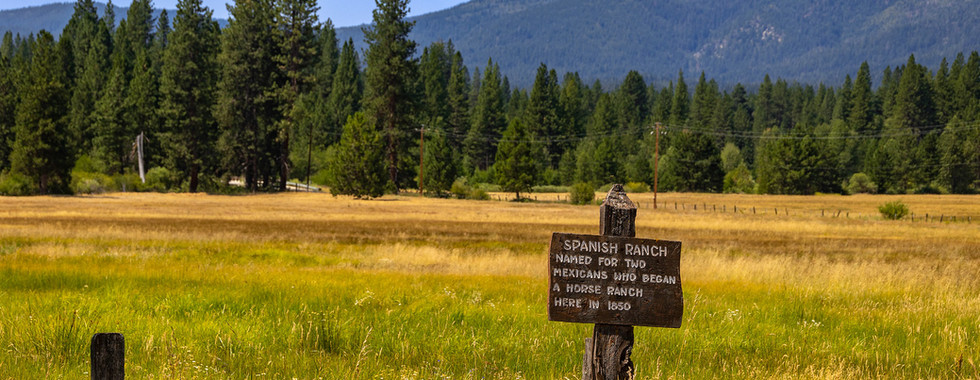
Beckwourth Emigrant Trail & Spanish Ranch
Spanish Peak-Meadow Valley Lumber Company
Bean Hill Mine
Butterfly Valley Botanical Area
Meadow Valley Lumber Company Aerial Tramway
Feather River Byway
Rush creek
North Fork Feather River
Seneca Historical Site
Swiss Mine
Butt Valley Reservoir
Land Managers & Other Resources
Permits & Papers
n/a

Adventure Badge: Get your Plumas BDT adventure badge at our online store.
Route Details
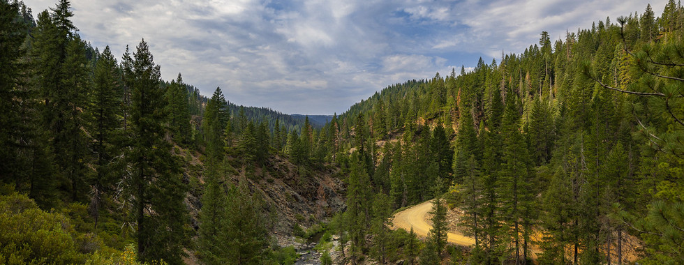
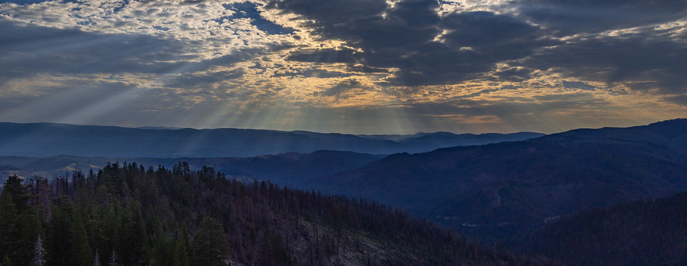
The Plumas Backcountry Discovery Trail is one of five California Backcountry Discovery Trails that were created by various National Forests across Northern California. As you may have guessed, the Plumas Backcountry Discovery Trail resides in the Plumas National Forest, an expansive forest covering more than 1.1 million acres across the northern Sierra Nevada. Unlike the Lake Tahoe region and central and southern Sierra, the northern Sierra tends to be light on crowds in comparison. You'll find pristine mountain streams and rivers, crystal clear lakes, mature pine forests, and a land that is filled with relics from the time when miners and pioneers filled the surrounding mountains. With 30 discovery points along the route, there are plenty of opportunities to take in the rich cultural heritage of California's pioneer and gold rush days.
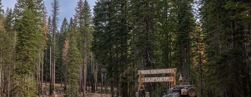
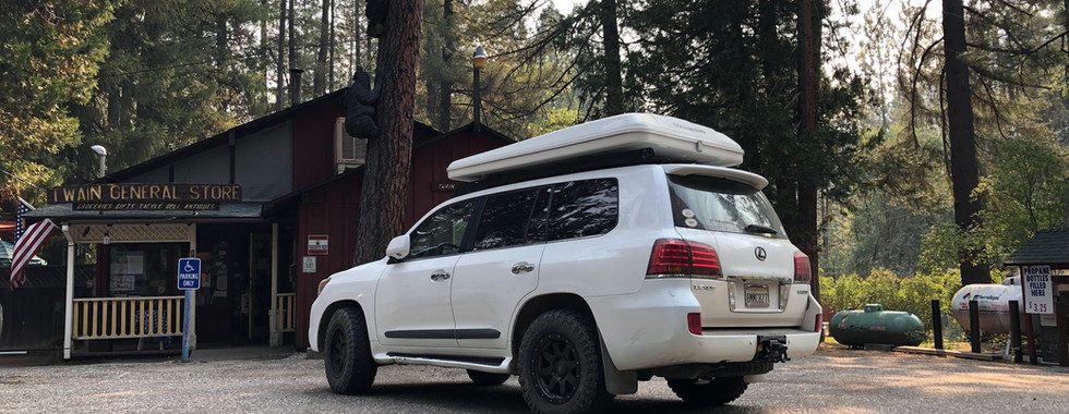
The route begins in the historic mining town of Downieville, which has been revitalized thanks to the many mountain bikers that flock to the surrounding trails every summer and fall. The route ascends a wide dirt road up Saddleback mountain. As you make your way to higher elevation, the majestic Sierra Buttes will come into view-- consider making a pitstop at Saddleback fire lookout for some great photo ops! From Saddleback mountain, the route makes its way towards the historic mining town of Poker Flat. Legend has it, that the town was named after the gold nuggets that were found in the nearby streams that were used as poker chips. Poker Flat OHV road is a slow going and rocky jeep trail that also includes a creek crossing right before Poker Flat OHV camp. Expect to spend 3-4 hours on Poker Flat, before the route returns to the much tamer fire roads and forest service roads along the route. The next leg of the journey passes a number of historic cemeteries, and if you pay attention to your map, you can explore the historic digging sites where prospectors tried to strike it rich. Making your way north from the tiny hamlet of La Porte, you'll pass a number of historic sites, including Nelson Creek, where millions of dollars of gold were extracted from the creek and surrounding hills. The route snakes its way north, crossing the middle fork of the Feather River. Various dirt roads circumvent Claremont peak, with the charming town of Quincy sitting at the base of its northern flank. There aren't a lot of amenities at the northern end of the route, so consider taking advantage of what's available in Quincy (fuel, restaurants, groceries). From Quincy, there are a couple of opportunities to view hydraulic mining sites at Spanish Creek and Bean Hill. Soon, you'll need to cross the mighty Feather river (not one of its tributaries like the middle fork), which is a local favorite for fishing and other aquatic recreation activities. Once you've crossed the main fork of the Feather River, you're on the final leg of the journey. Swiss mine, Rush Creek, and Seneca are all locations rich in mining and prospecting history. It was said that over $9 million worth of gold was taken from Rush Creek. As you make your way past Butt Valley Reservoir, the boundary that separates Plumas from Lassen National Forest will soon approach. The "official" start of the Lassen Backcountry Discovery Trail (and the end of the Plumas BDT), is right at the border where the two forests meet. If you're feeling adventurous, consider continuing your journey north on the Lassen Backcountry Discovery Trail!
Terms of Use: Should you decide to travel a route that is published on Overlandtrailguides.com, you do so at your own risk. Always take the appropriate precautions when planning and traveling, including checking the current local weather, permit requirements, trail/road conditions, and land/road closures. While traveling, obey all public and private land use restrictions and rules, and carry the appropriate safety, recovery, and navigational equipment. The information found on this site is simply a planning resource to be used as a point of inspiration in conjunction with your own due-diligence. In spite of the fact that this route, associated GPS track (GPX and maps), and all route guidelines were prepared under diligent research by Overland Trail Guides, the route accuracy and current conditions of roads and trails cannot be guaranteed.


The scenery looks amazing, and the detailed information makes it much easier to plan an unforgettable backcountry adventure. A free AI video to text converter is also a great tool for turning hiking videos into searchable trip notes and trail guides.
how many us cities can you name?
Just wondering if this route includes the segments of Poker Flat Trail that are actually failry technical. I've been on Poker Flat and it's definitely not a 4 of 10. More like 5-6 of ten. I wouldn't take any stock 4x4s except perhaps a stock Rubicon or Bronco. I noticed on the GPX files that the route departs the Poker Flat trail at 39.64292, -120.86164 and at 39.66384, -120.86108 - i hoping this routes us around the technical portions of Poker Flat
Dispersed camping is allowed in many areas of the national forest, and there are numerous campgrounds along the Geometry Dash route. Popular stops include Poker Flat, Pilot Lake, and several forest campgrounds.
What an incredible backcountry route! The scenery and trail details are inspiring. Even a great фон для авы can't compete with views like these!