
Mojave Road
- OTG Crew
- Nov 7, 2019
- 6 min read
Updated: Dec 22, 2025
The Mojave Road is one of North America's most iconic overland routes. Established over 200 years ago as a local trading route for the indigenous tribes of the area, the Mojave Road has gained cult-like status in the off road world. Come visit the majestic Mojave and discover why so many people keep coming back.


Route Overview
Trip Length & Season
Adventure Rating: Epic Trip Length: 138 miles, 1.5 - 3 days Season: The best time to visit is typically from mid-October to April. Summer temps regularly exceed 110F in the desert.
Digital Maps & GPX Files
Download Digital Mapping Files
Mojave Road (with Discovery Points & POIS) For Subscribers
If you need help working with digital mapping and GPX files, please check out our FAQ section.

Technical Ratings & Terrain
Avg Technical Rating: 2
Peak Technical Rating: 4
Typical Terrain: Along the way you can expect to encounter deep sandy, large washes, whoops, some rocks, and one hill that can pose a challenge to vehicle with limited articulation (Sprinter vans). Paiute Pass has also gone from an easy trail to a moderate trail due to the increased intensity of recent winter storms. The water crossing at Afton Canyon regularly reaches 3' and sometimes higher. Vehicles like Subarus may have trouble with this section and may want to consider using the Afton Canyon Reroute.
Recommended Vehicle / Moto / Adventure Vans
Recommended Vehicle: Stock 4x4
Recommended Moto: A midweight bike is recommended due to the numerous sandy sections and uneven terrain on parts of the Mojave Road. Motos may wish to skip deep water crossing through Afton canyon by taking the Afton Canyon Reroute.
Adventure Vans: Most of the route shouldn't be an issue for Sprinters, but they may wish to utilize the bypass around Paiute Pass, and take caution on the pock marked hill that will test your Sprinter's articulation. Choose the right line and take it slow, and you should be fine.
Fuel, Provisions and Gear
Fuel: It's approxomiately 170 miles between gas stations in Bullhead City and Yermo. It is possible to depart the track and head a few miles north to Baker (about 2/3 of the way through the Mojave Road) to refuel. Provisions: Provisions can be obtained in the same general vicinity as fuel. Gear: No specialized gear is recommended for this adventure.
Alternative Routes
Paiute Pass Reroute Distance: 14 miles Technical Rating: 1-2 Trail conditions have detiorated significantly over Paiute Pass in recent years. For those looking for an easy way around Paiute Pass, use this reroute. Sprinters, AWD crossovers, and Big Bikes may wish to take the reroute.
Caruthers Canyon Distance: 16 miles Technical Rating: 2-3 We highly recommend taking the Caruthers Canyon track, which takes you up into the boulder fields of Caruthers Canyon and the surrounding New York mountains. Not only is it scenic, there's a number of incredible campsites in the canyon and surrounding area.
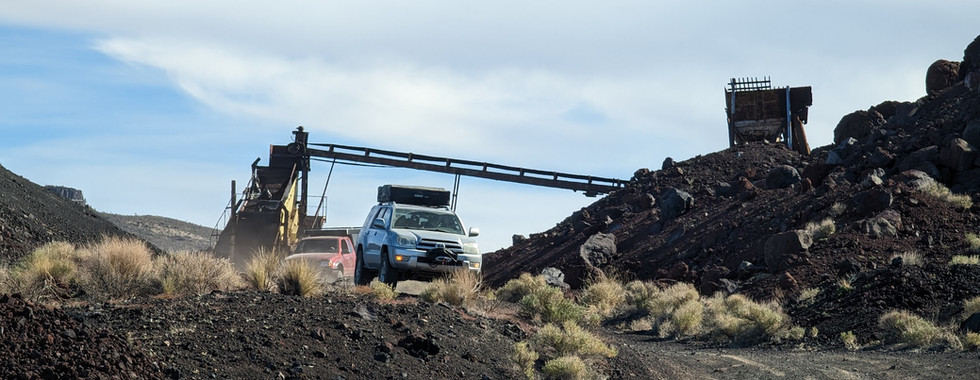
Cinder Cone Lava Fields
Distance: 23 miles Technical Rating: 2 Another alternative route that we highly recommend taking is through the Cinder Cone Lava Fields. The lava fields create a unique landscape, that almost feels alien. In addition to the access to the Aiken Cinder Cone Mine and Mojave Lava Tube, the area contains numerous campsites spreadout across the lava fields. The sunsets and sunrises are truly something else out here! Just make sure you've got some solid tires, as the volcanic rock and pumice can be quite sharp.
Afton Canyon Bypass
Distance: 15 miles Technical Rating: 2 Motos and low clearance AWD vehicles (Subarus) may wish to skip the Mojave River crossing in Afton Canyon, that has been known to exceed 3'.
Camping Recommendations
The Mojave National Preserve along the Mojave Road has hundreds of dispersed camping sites. Some of our favorite places to camp along the track include:
OX corral
Caruthers canyon
Cinder cone lava fields
Green Rock Mill
Rasor Road
Afton Canyon (train does run through the middle of the night though!)
Discovery Points
P1 - Colorado River
P2 - Fort Paiute
P3 - OX Ranch Corral
P4 - Penny Can Tree
P5 - Lanfair (site)
P6 - Caruthers Canyon
P7 - New York Mountain
P8 - Bert Smith Cabin (Rock Cabin)
P9 - Cima Dome
P10 - Marl Springs
P11 - Mojave Mailbox #1
P12 - Aiken Cinder Pit Mine
P13 - Mojave Lava Tube
P14 - Cinder Cone Lava Fields
P15 - Soda Lake
P16 - Travellers Monument
P17 - Zzyzx Ghost Town
P18 - Afton Train Trestles
P19 - Buried Boxcars
P20 - Spooky Canyon
P21 - Afton Canyon
P22 - The "Caves"
P23 - Afton Station (site)
P24 - The Triangles
Land Managers & Other Resources
Permits & Papers
The Mojave National Preserve does not charge a fee like most other parks managed by the the National Park Service.

Adventure Badge Get your Mojave Road adventure badge (decal or patch) at our online store.
Route Details
Chances are that you've heard or read about Mojave Road from a friend, on a forum, or perhaps you stumbled across it on someone's Instagram feed. And for good reason, the Mojave is a magical, and some would even say mythical place. The desert rats, artists, and eccentrics who call the desert have all been drawn by its ethos. Whether you're big on historical sites, geological wonders, or challenging terrain, the Mojave has got you covered (you'll need to explore some of the side trails for technical terrain).
Most traffic along the Mojave Road travels driven from west to east, although it can be driven in either direction. While the Mojave can be driven just about any time of year, due to extreme temperatures during the summer months (that can top out at 120 F), most people tend to run the Mojave between October and May. If you're not a fan of sub-freezing temperatures, consider running the route in fall or spring. The vast majority of the route can be easily traversed by a stock 4x4. The biggest challenge that newcomers typically face, is keeping on the trail, as numerous roads and trails make it difficult to discern which road you should be on. It's recommended that you load a gpx track to your favorite mapping app, while remaining vigilant of your location in relation to the track (we're also big fans of paper maps and recommend Mojave Guide Book, which contains a wealth of information about the route and surrounding areas).
Along the 138 mile route, you'll pass numerous historical sites and ruins, dried lake beds, numerous washes, slot canyons, and lava flows (caves). And don't forget the funkiness factor, the desert is loaded with strange stories and even stranger characters (hello Charles Manson). Some of the more bizarre sites along the route include the old Mojave bus, penny can tree, and frog shrine (weird shit happens in the desert). Take away all of the history and weirdness, and you're still left with the stunning desert landscape. Despite the harsh conditions of the desert, and if you time your visit right, you may just be lucky enough to experience one of the Mojave's desert blooms. Another favorite plant/tree of the region, is the legendary Joshua Tree, which can be found throughout the Mojave (and their namesake, Joshua Tree National Park).
If you live in California or the southwest, you need to make the pilgrimage to the Mojave Road at least once in your lifetime. The Mojave is a place where friendships are born, memories are created, and wisdom is shared. If you haven't made the pilgrimage, better start planning!
Terms of Use: Should you decide to travel a route that is published on overlandtrailguides.com, you do so at your own risk. Always take the appropriate precautions when planning and traveling, including checking the current local weather, permit requirements, trail/road conditions, and land/road closures. While traveling, obey all public and private land use restrictions and rules, and carry the appropriate safety, recovery, and navigational equipment. The information found on this site is simply a planning resource to be used as a point of inspiration in conjunction with your own due-diligence. In spite of the fact that this route, associated GPS track (GPX and maps), and all route guidelines were prepared under diligent research by overlandtrailguides.com, the route accuracy and current conditions of roads and trails cannot be guaranteed.