
Lassen Backcountry Discovery Trail
- OTG Crew

- Jan 15, 2020
- 6 min read
Updated: Jan 1
The land of Ishi and Peter Lassen. The Lassen Backcountry Discovery Trail is where the northern Sierra meets the southern Cascades. It's a land that's rich in aboriginal and pioneer history, but its natural splendor an unspoiled wilderness will mesmerize any nature lover.


Most photos courtesy of Adventure Taco. Be sure to check out the Lassen BDT trip report from Adventure Taco.
Route Overview
Trip Length & Season
Adventure Rating: Epic Trip Length: 181 miles, 3-5 days Season: June to early November, but may vary depending on early/late season snow.
Digital Map & GPX Files
Download Digital Mapping Files
Lassen Backcountry Discovery Trail *If you need help working with digital mapping and GPX files, please check out our FAQ section.

Technical Rating & Terrain
Avg Technical Rating: 2-3
Peak Technical Rating: 3-4
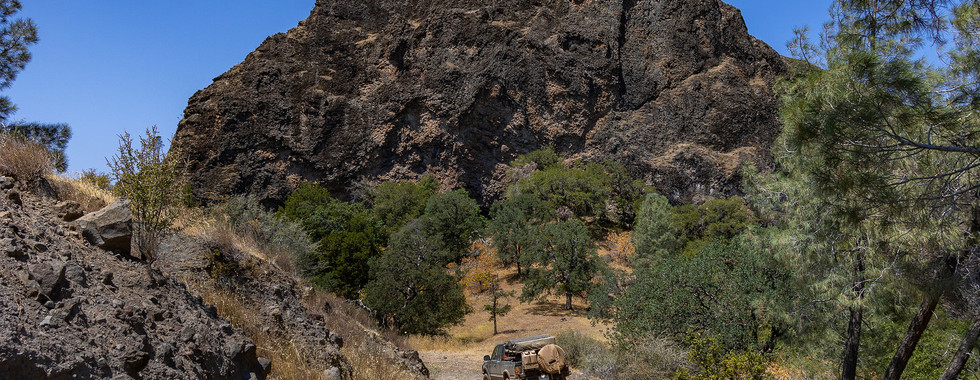
Typical Terrain: The track consists primarily of graded dirt forest service roads, and a few narrow secondary dirt roads. There is some minimal connecting pavement.
Recommended Vehicle / Moto / Adventure Vans
Recommended Vehicle: A stock 4x4 or AWD vehicle with A/T tires.
Recommended Moto: A mid-weight or bike bikes should be able to handle this track.
Adventure Vans: Yes! Sprinter 4x4s are good to go!
Fuel, Provisions, and Recommended Gear
Fuel: The first leg is the longest between fuel stops, which is approximately 215 miles from Chester (northern Lake Almano) to Old Station. Gas from Old Station (via Highway 89 north back to the BDT) to Macarthur is approximately 60 miles.
Provisions: Provisions can be obtained at most fuel stops, in addition to the store in Mineral.
Gear: no specialized gear is needed on this trip.
Alternative Routes
Peligreen Jeepway
Distance: 25 miles
Technical Rating: 5
The Peligreen Jeepway offers the one true jeep trail along the Lassen BDT. While the trail is rocky and a lot of fun, expect to pick up a fair amount of pinstripes, as the trail is rather narrow in many sections.
Turner Mountain Loop
Distance: 39 miles
Technical Rating: 2-3 The Turner Mountain Loop is one of the official discovery points along the Lassen BDT. Over the course of 39 miles, you'll circle Turner Mountain and climb to the top of its 6,834' summit.
Burney Mountain
Distance: 19 miles
Technical Rating: 2 This track leads to the top of Burney Mountain with fantastic views of the southern Cascades. There are some shelf roads with exposure, but the trail is relatively mild.
Modoc & Plumas BDTs You can extend your journey to the south via the Plumas BDT, and to the north by using the connector to the Modoc BDT. For more information about these Backcountry Discovery Trails, check out:
Camping Recommendations
Some of our favorite locations for camping along the Lassen BDT include:
Yellow Creek
Black Rock Campground
Brokeoff Meadows
Blue Lake Canyon
Discovery Points
More info about each discovery point can be found within the official Lassen BDT guide published by the Lassen NF.
DP1 - Yellow creek camp
DP2 - Humbug Valley
DP3 - Cold Springs PCT
DP4 - Humboldt Summit
DP5 - Colby Lookout
DP6 - Deer Creek
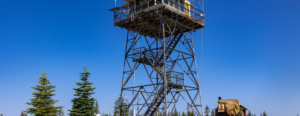
DP7 - McCarthy Lookout
DP8 - The Narrows
DP9 - Bruff's Camp
DP10 - Ishi Wilderness
DP11 - Black Rock
DP12 - Mill Creek
DP13 - Peligreen OHV
DP14 - Turner Mountain Loop
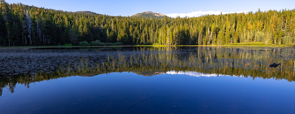
DP15 - Heart Lake
DP16 - Brokeoff Meadows
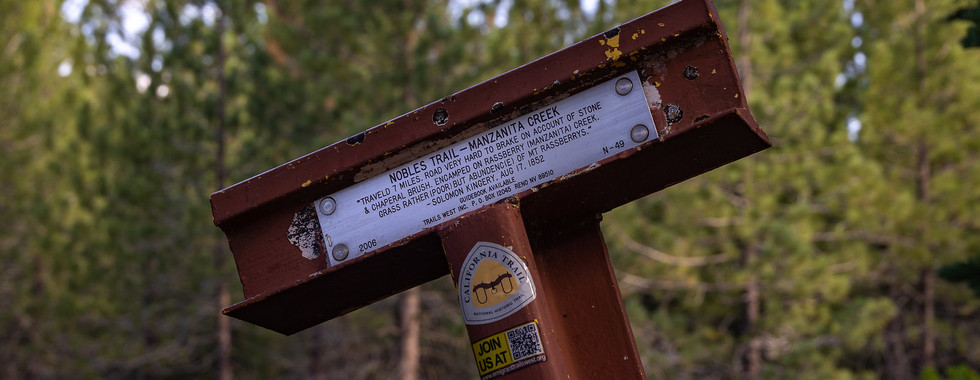
DP17 - Nobles Trail
DP18 - Burney Springs
DP19 - Cypress Trail
DP20 - Cornaz Lake
DP21 - Hat Creek Observatory
DP22 - Murken Bench
DP23 - Hang Gliding
DP24 - Hat Creek Rim
DP25 - Lassen Trail
Land Managers & Other Resources
Land Managers
Other Resources
Permits & Papers
You'll need to pay the entrance fee if you plan to visit Lassen Volcanic NP. Click for latest fee schedule.
Adventure Badge OTG has partnered with All Roads Taken to offer an adventure badge for this route. >> Buy your adventure badge today!

Route Details
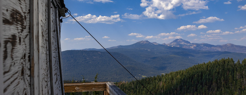
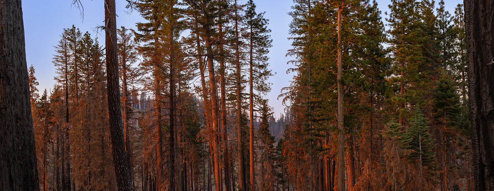
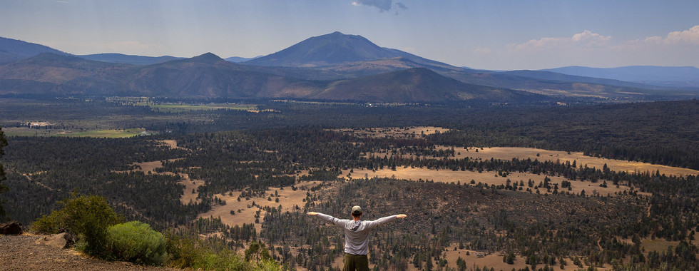
The Lassen Backcountry Discovery Trail is a place where two great mountain ranges meet. The trail begins in the northern Sierra, a mountain range known for its granite monoliths and glacier carved valleys (Yosemite, Kings Canyon). At Mount Lassen, the mighty Sierra give way to the Cascades, a range famous for its many picturesque and snow capped volcanic peaks. Aboriginal tribes have been living in the area for the last 10,000 years, and pioneers like Peter Lassen pioneered wagon trails through the forest and over the mountains. Thousands of prospectors followed these trails to the various gold fields in the region. The Ishi Wilderness is named after the last Native American, who emerged from these forests in 1911. Like the Plumas BDT, the Lassen is rich with in aboriginal, pioneer, and mining history. While not part of the official route, if you have the time, we recommend visiting the picturesque Burney Falls and Lassen National Park. The route begins at a rather inconspicuous location-- the boundary where the Plumas National Forest meets the Lassen. The route heads north as it traverses the southern and western flanks of Humboldt peak. The road to Humboldt Peak and Colby lookout are both worth visiting, as they provide exquisite views of the Sierra and Cascades. From Colby lookout, you'll soon cross Deer Creek, which is one of the major stealhead and salmon spawning habitats in the headwaters of the Sacramento River. You're now on section of the Lassen Trail. Bruff's camp has several small volcanic monuments dedicated to a group of emigrants that travelled the Lassen Trail. Down the northern slope of the mountain sits Mill Creek, and the iconic Black Rock (and a campground of the same name). This is a great place to cool off when the summer heat is on. Keep an eye on the local scenery, see if you can notice the transition from the granite of the Sierra to the black lava fields of the Cascades. The trail skirts along the lower elevation slopes of Turner Mountain, before crossing Highway 36. Like many of the other mountain peaks in the forest, Turner Mountain is blessed with a fire lookout. Departing from Highway 36, the route ascends onto a volcanic shelf, and soon the iconic snow capped peak of Lassen makes a stunning appearance with the surrounding volcanic peaks. Heart Lake is a great little side adventure, that requires a 1.8 mile hike to reach. The Chaos Crags make for an interesting set of volcanic formations, which can be reach with a short drive from Highway 44 and onto Highway 89.
Once you've crossed Highway 44, you'll be on the final stretch of the route and deep into Cascade volcano country. Buttes and lava domes are prevalent along this section, with Crater Peak (elev. 8,685 feet) dominates the immediate landscape. As you cross Highway 89, keep an eye out for the massive black rock lava flows that you'll soon traverse. Not far from the lava flow, you'll find Hat Creek Observatory, which is a great place to stargaze. Just east of the observatory, look for a rift in the lava flow, which is known as Murken Bench. Murkey Bench is actually a fault, which happens to only be tens of thousands of years old (young in fault years!). Just up the mountain sits Hat Creek Rim, another excellent example of a fault exemplifying the tectonic forces in action, as faults uplift the surrounding rock and soil. The Lassen BDT follows a section of the original Lassen Trail before meeting its terminus at Little Valley.
Terms of Use: Should you decide to travel a route that is published on Overlandtrailguides.com, you do so at your own risk. Always take the appropriate precautions when planning and traveling, including checking the current local weather, permit requirements, trail/road conditions, and land/road closures. While traveling, obey all public and private land use restrictions and rules, and carry the appropriate safety, recovery, and navigational equipment. The information found on this site is simply a planning resource to be used as a point of inspiration in conjunction with your own due-diligence. In spite of the fact that this route, associated GPS track (GPX and maps), and all route guidelines were prepared under diligent research by Overland Trail Guides, the route accuracy and current conditions of roads and trails cannot be guaranteed.


Comments