
East Mojave Heritage Trail
- OTG Crew

- Nov 11, 2022
- 9 min read
Updated: Dec 22, 2025
The East Mojave Heritage Trail is an epic 700+ mile adventure through some of the lesser traveled areas within the East Mojave Desert and Mojave National Preserve. While the Mojave Road seems to get all the glory in these parts, the much longer EMHT is action packed with geological wonders and interesting history and sights around just about every corner.
Route Overview
Trip Length & Season
Adventure Rating: Baja
Trip Length: 7-14 days, approximately 740 miles
Season: October through May, but late winter to early spring tends to bring mild temps with more greenery and desert blooms. Summer travel is not advised as desert temps can exceed 110F.
Digital Maps & GPX Files
Download Digital Mapping Files
East Mojave Heritage Trail with Discovery Points (premium membership)
If you need help working with digital mapping and GPX files, please check out our FAQ section.

Technical Ratings & Terrain
Avg Technical Rating: 2-3
Peak Technical Rating: 4
Typical Terrain: Graded dirt and gravel roads, sandy washes, narrow trails and two track, and rocky jeep tracks.
Recommended Vehicle / Moto / Adventure Vans
Recommended Vehicle: Stock 4x4
Recommended Moto: A mid-weight bike or dual is recommended given some of the moderate terrain with sizable sections of sandy washes and trails.
Adventure Vans: While a Sprinter 4x4 can manage the vast majority of the route, there are sections that are off camber, narrow, and some small ledges that may prove difficult for Sprinter and Transit vans to navigate. Because of this, the EMHT is not deemed suitable for Sprinters and Transit vans.
Fuel, Provisions, and Recommended Gear
Fuel Seg 1
Needles to Searchlight 140mi, Searchlight to Primm 45mi Fuel Seg 2
Primm to Baker 100mi, Baker to Ludlow (seg3) 160mi
Fuel Seg 3
Ludlow to Amboy 30mi, Ludlow to Fenner 130mi
Fuel Seg 4
Fenner to Vidal Junction 95mi, Vidal Junction to Needles 85mi Provisions: Provisions can be obtained in the same general vicinity as fuel. Gear: no specialized gear is recommended for this adventure.
Alternative Routes
n/a
Camping Recommendations
The Mojave National Preserve has attracted folks seeking solace in the desert for decades. There are quite literally hundreds of fantastic camp sites along the route. Some of our favorite places to camp include: Segment 1
Goff's School House (fee)
OX Ranch Corral / Piute Corral
Caruthers Canyon
Segment 2
Curtis Cabin
Riggs cabin vicinity
Cree camp
New Era mines & cabins vicinity
Aiken Mine
Cinder cone lava fields
Segment 3
Granite Pass vicinity
Kelso dunes
Wild Horse Canyon Road near Hole-in-the-wall
Segment 4
Brown's camp vicinity
Pyramid Butte vicinity
West Well Archeological site vicinity
Discovery Points & EMHT Mailboxes
EMHT Mailboxes
When the East Mojave Heritage Trail was officially introduced to the public, the trail had one mailbox per segment. These mail boxes were used by the BLM and later NPS to monitor traffic on the EMHT. Into do the 4 mailboxes along the EMHT, the old Mojave Road Mailbox #2 has been relocated to Goffs Schoolhouse. We've provided the approximate locations of these three mailboxes in our GPX files for subscribers. Please be sure to sign in if you're lucky enough to find one of these mailboxes.
EMHT Mailbox #1 (segment 1)
EMHT Mailbox #2 (segment 2)
EMHT Mailbox #3 (segment 3)
EMHT Mailbox #4 (segment 4)
Mojave Road Mailbox #1 (Mojave Road)
Mojave Road Mailbox #2 (Goffs Schoolhouse)
Discovery Points The entire East Mojave Heritage Trail contains over 100 discovery points curated by OTG, many of which are referenced in the 4 volume EMHT Guide Books by Dennis Casebier. If you'd like a detailed guide of the EMHT, we highly recommend purchasing a subscription that contains the specific locations of each discovery point, recommended camp sites, EMHT mail boxes (approximate locations) and other interesting points of interest.
Segment 1
S1/DP1 - Colorado River
S1/DP2 - National Old Trails Monument
S1/DP3 - El Garces Train Depot
S1/DP4 - Sacramento Mountains
S1/DP5 - Eagle Pass
S1/DP6 - Flattop Mountain
S1/DP7 - Bigelo Cholla Garden Wilderness
S1/DP8 - Mojave Bus
S1/DP9 - Goffs Schoolhouse Museum
S1/DP10 - Goffs Railway Depot
S1/DP11 - Leiser Ray Mine
S1/DP12 - Fort Piute
S1/DP13 - Piute Corral
S1/DP14 - The Penny Can Tree
S1/DP15 - Dunbar (site)
S1/DP16 - Lanfair (site)
S1/DP17 - Rock Spring House
S1/DP18 - Rock Spring Petroglyphs
S1/DP19 - New York Mountains
S1/DP20 - Caruther's Canyon
S1/DP21 - Easter Island Rock
S1/DP22 - Tin Camp
S1/DP23 - Castle Mountains National Monument
S1/DP24 - CA-NV Stateline
S1/DP25 - Searchlight
S1/DP26 - Searchlight Historic Museum
S1/DP27 - Nipton Historical Village
S1/DP28 - Ivanpah Solar Farm
S1/DP29 - Old Ivanpah (site)
Segment 2
S2/DP1 - Coliseum Mine
S2/DP2 - Curtis Cabin
S2/DP3 - Clark Mountain
S2/DP4 - Kelly Field
S2/DP5 - Kingston Peak
S2/DP6 - Coyote Holes
S2/DP7 - Valjean (site)
S2/DP8 - Silurian Lake Playa
S2/DP9 - Riggs (site)
S2/DP10 - Riggs Cabin
S2/DP11 - Jake's Cabin
S2/DP12 - Silver Lake Mines
S2/DP13 - Silver Lake Cemetery
S2/DP14 - Baker
S2/DP15 - Zzyzx
S2/DP16 - Soda Lake Playa (Mojave River Sink)
S2/DP17 - Cree Camp
S2/DP18 - Hytens Well
S2/DP19 - Wanderer Mine
S2/DP20 - Wanderer Mine Crack
S2/DP21 - Toltec Turquoise Mine (West Camp)
S2/DP22 - Turquoise Mountain
S2/DP23 - Valley Wells Smelter
S2/DP24 - Mountain Pass Mine
S2/DP25 - Squalor Camp / Kokoweef Inc Mine
S2/DP26 - Standard Mine
S2/DP27 - Riley's Grave
S2/DP28 - Greer Camp
S2/DP29 - J. Riley Bembry Cabin
S2/DP30 - New Era Mines
S2/DP31 - Evening Star Mine
S2/DP32 - Hartman Mine
S2/DP33 - Mojave Cross
S2/DP34 - Cima Volcanic Dome
S2/DP35 - Cow Cove Petroglyphs
S2/DP36 - Cima Cinders Mine
S2/DP37 - Mojave Phone Booth Memorial
S2/DP38 - Cinder Cone Lava Fields
S2/DP39 - Aiken Mine
S2/DP40 - Lava Teepee
S2/DP41 - Mojave Lava Tube
Segment 3
S3/DP1 - Rocky Ridge
S3/DP2 - Devil's Playground Dunes
S3/DP3 - Crucero Lake (Playa)
S3/DP4 - Tonopah & Tidewater RR Berm
S3/DP5 - Mojave Megaphone
S3/DP6 - Crucero (site)
S3/DP7 - Broadwell Lake Playa
S3/DP8 - Old Murphy General Store
S3/DP9 - Ludlow Cemetery
S3/DP10 - Siberia Crater (Dish Hill)
S3/DP11 - Bagdad (site)
S3/DP12 - Lance Corporal Jason Rother Memorial
S3/DP13 - Amboy Airfield
S3/DP14 - Roy's Sky Motel & Cafe
S3/DP15 - Route 66 pavement sign
S3/DP16 - Amboy Crater
S3/DP17 - Orange Blossom Mine
S3/DP18 - Budweiser Spring
S3/DP19 - Granite Mountains
S3/DP20 - Boulders Viewpoint
S3/DP21 - Kelso Dunes
S3/DP22 - Kelso Depot Visitor Center
S3/DP23 - Kelso Chinese Cemetery
S3/DP24 - Vulcan Mine
S3/DP25 - Mitchell Caverns
S3/DP26 - Fountain Peak
S3/DP27 - Providence Ghost Town
S3/DP28 - Bonanza King Mine
S3/DP29 - Silver King Mine
S3/DP30 - HITW Visitor Center
S3/DP31 - Hole in the Wall
Segment 4
S4/DP1 - Fenner
S4/DP2 - Camp Clipper Air strip
S4/DP3 - Piute Mountains Wilderness Area
S4/DP4 - Burning Shoe Wash
S4/DP5 - Little Piute Mountains
S4/DP6 - Old Woman Mountains
S4/DP7- Goldstar Mines / Sunflower Springs
S4/DP8 - Lucky Jim Mine
S4/DP9 - Brown's Camp
S4/DP10 - Turtle Mountains
S4/DP11 - Pyramid Butte
S4/DP12 - New American Eagle Mine
S4/DP13 - West Well Archaeological Site
S4/DP14 - Chemehuevi Mountains
Land Managers & Other Resources
Land Managers
Other
We highly recommend purchasing Dennis Casebier's 4 volume guidebooks series for the East Mojave Heritage Trail. The guidebooks can be purchased online from the Mojave Desert Heritage & Cultural Association.
Permits & Papers

Adventure Badges: EMHT Decals and Patches are now available to purchase at the MDHCA store.
Route Details
The East Mojave Heritage Trail was developed in the 1980s as an alternate overland route to the better-known (and much shorter) Mojave Road by Dennis Casebier. Even back then, the Mojave Road was seeing a reasonable amount of vehicle traffic. Casebier's goal with the East Mojave Heritage Trail was to disperse vehicle traffic throughout the East Mojave region while also introducing travelers to its lesser-visited areas. As he did with the Mojave Road, Casebier created a series of guidebooks—one for each of the four segments of the EMHT—containing detailed information about the region’s past, mining history, railroads, industrial developments, quirky stories, geology, flora, and fauna. We highly recommend purchasing the guidebooks given the wealth of information they contain. However, it's important to note that the current iteration of the East Mojave Heritage Trail has been revised and updated to bypass wilderness boundaries that were implemented after Casebier’s guidebooks were published.
The four segments of the East Mojave Heritage Trail largely sit within the 1.5 million acres of the Mojave National Preserve. The route visits well-known locations like Kelso Dunes, as well as many places off the beaten path. Given the length of the trail and the existence of Casebier’s guidebooks, OTG’s route guide provides a general overview of what to expect while exploring the EMHT. We encourage all travelers to purchase the guidebooks to gain the most informative experience. The East Mojave Heritage Trail is broken down into four distinct segments:
Segment 1: Needles to Ivanpah – 173 miles
Segment 2: Ivanpah to Rocky Ridge – 199 miles
Segment 3: Rocky Ridge to Fenner – 211 miles
Segment 4: Fenner to Needles – 155 miles
Each segment has a unique character and history. Segments 1 and 2 are rich with mining history. Segment 2 also features volcanic landscapes like the cinder cone lava fields. Segment 3 showcases unique geological features such as Kelso Dunes, Hole-in-the-Wall, and Mitchell Caverns. Segment 4 tends to focus on the natural and geological history of the East Mojave. Needless to say, there’s something for everyone along the EMHT—whether you're into stargazing, hiking, exploring local flora and fauna, spelunking, or learning about early pioneers and the Indigenous peoples who once called this part of the Mojave home.
We spent hours poring over the four guidebooks, translating the wealth of information from Dennis Casebier into over 100 discovery points. These points lead to locations such as old townsites, mining camps and cabins, caves, lava fields, unique geological formations, and strange desert oddities—like the Mojave Megaphone. We’ve also included a number of discovery points that aren’t mentioned in Casebier’s guidebooks but are relevant to telling the story of the East Mojave. We hope you enjoy the research and hard work that went into developing the most complete digital mapping file available for the East Mojave Heritage Trail!
The nearly forgotten East Mojave Heritage Trail was recently resurrected by Billy Creech, who spent countless hours exploring the desert to create an updated version of the EMHT. With its rebirth, the EMHT is poised to become one of North America's iconic overland routes.
Rebirth of the East Mojave Heritage Trail
Dennis Casebier spent years exploring the desert and writing his Mojave Road and East Mojave Heritage Trail guidebooks. He was aware of the possibility that wilderness research areas could cut off vehicular access to parts of the EMHT—which is exactly what happened shortly after the guidebooks were published in the early 1990s, making through-passage impossible on certain segments. Aside from a handful of desert rats, history buffs, and off-road misfits who still traveled the EMHT, the route was largely forgotten. That is, until Billy Creech came across the guidebooks and began exploring the original tracks, researching, and developing new routes to bypass wilderness areas and trail closures.
Hailing from Southern California and now based in southwest Idaho, Billy grew up enjoying the outdoors. His first remote exploration trip was in the ’80s, when he joined his girlfriend’s family in their Scout on a trip to Death Valley. A certified Master Diver, he has worked in water search and rescue and is now a corporate supply chain strategist and planning professional. His passion for outdoor exploration, hiking, and camping evolved into overland exploration and eventually scientific expeditions. He is happiest when exploring remote areas—sharing skills, enjoying nature, meeting people, and making new friends while cooking over an open fire and swapping stories.
Billy is an elected member of The Explorers Club and is considered a subject matter expert on exploration, particularly in desert environments. He holds an MBA from Cornell University, serves as the President of the Board of Directors for the Mojave Desert Heritage & Cultural Association, and is a published author and poet. He is also a frequent guest on various exploration podcasts and a two-time recipient of the Mojave Road Wagon Master Award.
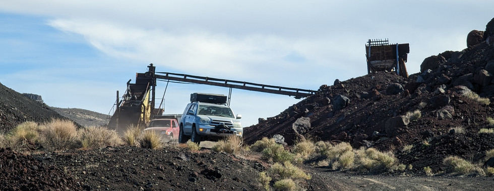
Gallery


Terms of Use: Should you decide to travel a route that is published on Overlandtrailguides.com, you do so at your own risk. Always take the appropriate precautions when planning and traveling, including checking the current local weather, permit requirements, trail/road conditions, and land/road closures. While traveling, obey all public and private land use restrictions a
nd rules, and carry the appropriate safety, recovery, and navigational equipment. The information found on this site is simply a planning resource to be used as a point of inspiration in conjunction with your own due-diligence. In spite of the fact that this route, associated GPS track (GPX and maps), and all route guidelines were prepared under diligent research by Overland Trail Guides, the route accuracy and current conditions of roads and trails cannot be guaranteed.


Comments