
Death Valley Adventure Route
- OTG Crew

- Nov 26, 2019
- 10 min read
Updated: Dec 22, 2025
Death Valley, the famous home of the Manson Family. Things can get a bit weird out in this part of the desert, but natural wonders and relics of the past will keep you yearning for more.
Route Overview
Trip Length & Season
Adventure Rating: Epic Trip Length: 421 miles, 4-8 days Season: The best time to visit is typically mid-October to early May. Death Valley can experience snow at higher elevations when cold winter storms blow through. Traveling the route in summer is not advised as temperatures regularly exceed 115F in the park.
Digital Maps & GPX Files
Download Digital Mapping Files
If you need help working with digital mapping and GPX files, please check out our FAQ section.

Technical Ratings & Terrain
Avg Technical Rating: 2
Peak Technical Rating: 5-6
Typical Terrain: The track includes everything from high speed dirt roads with washboards, sections of deep sand (Saline Valley), bumpy and steep jeep tracks with exposure, and the waterfall section through Dedeckera Canyon, that is the most technical portion of the route. There is some interconnecting pavement.
Recommended Vehicle / Moto / Adventure Vans
Recommended Vehicle: High Clearance 4x4
Recommended Moto: A dual sport bike is recommended to take on the main track while a big bike or mid-weight bike can take on the easy version (see alternative routes for more info).
Adventure Vans: Sprinters are not recommended on the main track, but they are suitable for the easy version (see alternative routes for more info).
Fuel, Provisions, and Recommended Gear
Fuel: Route start to Furnace Creek is 90 miles, Furnace Creek to Beatty is 45 miles, Beatty to Lone Pine is 270 miles
Provisions: Provisions can be obtained in the same general vicinity as fuel.
Gear: no specialized gear is recommended for this adventure.
Alternative Routes
Death Valley Easy
Distance: 414
Technical Rating: 3 The vast majority of the easy route follows graded dirt roads that a 2WD vehicle can handle. There are some sections of deep sound around the Saline Valley Dunes along with some mildly bumpy and rocky sections as you ascend and then drop into Titus Canyon. The biggest challenge with the easy route is fuel, specifically going from Beatty to Panamint Springs, which is about 245 miles.
Camping Recommendations
In the not-so-distance past, dispersed camping was allowed along dirt roads at least one mile away from any paved road or "day use only" dirt road. However, this changed in 2024 with many popular dispersed camping locations like Hole-in-the-wall, Echo Canyon, and Marble Canyon Camp now requiring online reservations at one of the designed campsites. There are still many areas within the park that permit dispersed camping, but we recommend checking on the latest information provided by the park on this page. Campfires are not allowed anywhere in the park except at developed campgrounds. Additionally, Alabama Hills now requires the obtaining of a free camping permit, which does not guarantee a reserved site. Some of our favorite places to camp include:
Saline Valley Warm Springs camp (fires permitted)
Eureka Dunes (fires permitted)
Homestake Camp (fires permitted)
Hole in the Wall (reservation required)
Marble Canyon (reservation required)
Echo Canyon (reservation required)
Alabama Hills (free camping permit required)
Trail Canyon
Chloride Cliffs vicinity
Johnson Canyon
Boulder Camp
Lee Flat
Hidden Valley
Discovery Points
Ashford Mill Ruins
Badwater Basin
Morning Glory Mine
Artist's Palette
Golden Canyon
Zabriskie Point badlands
Hole in the Wall
Furnace Creek Visitor Center
Mesquite Flat sand dune field
Grotto Canyon
Keane Wonder Mine Mill
Chloride City
Chloride Cliff Viewpoint
Rhyolite Ghost town
Goldwell Open Air Museum
Tom Kelly's Bottle House
Beatty
Leadfield Ghost town
Titus Canyon (one way)
Scotty's Castle
Ubehebe Crater
Crankshaft Junction
Eureka Dunes
Last Chance Mountains
Dedeckera Canyon
Steele Pass
Marble Bath
Saline Valley Warm Springs
Inyo Mountains
Salt Lake
Lippincott Pass Road
Racetrack playa
Teakettle Junction
Hidden Valley
Panamint Valley Overlook
Lee Flat Joshua Tree Forest
Cerro Gordo Peak
Cerro Gordo Ghost Town
Salt Tram
Owens Valley
Alabama Hills & Movie Road
Mobius Arch
Mt Whitney
Manzanar Internment Camp
Land Managers & Other Resources
Permits & Papers
You will need to pay park fees when entering Death Valley National Park. More info on fees can be found HERE.
Adventure Badge
OTG has partnered with All Roads Taken to offer an adventure badge for this route.

Route Details
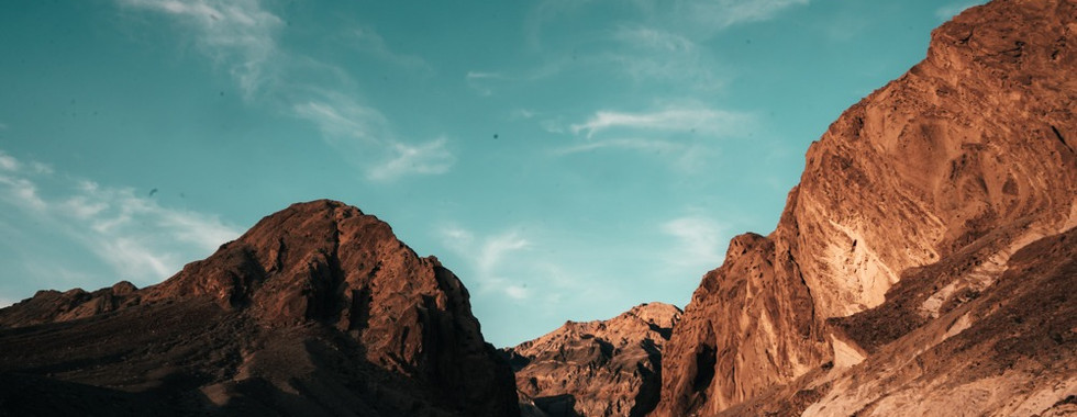
At 3.4 million acres, Death Valley is the largest national park in the contiguous United States. The park straddles portions of the Great Basin and Mojave deserts, in a land of unforgiving extremes. Not only is Death Valley one of the driest places on earth (average rainfall is less than 2 inches), it also holds the record for the hottest ever recorded temperature (134°F). The parched desert landscape creates quite the juxtaposition with the various subranges of the Basin Ranges within the park, and the rugged Mt. Whitney and domineering eastern sierra looming over the desert to the west. During your time at the park, you'll have the opportunity to see and experience lava flows and craters, rugged jeep trails, picturesque mountain peaks, ghost towns and abandoned mining times, eclectic art displays, petroglyphs, salt flats, wandering burros, hot springs, and so much more.
The route begins halfway between Baker and Shoshone near the Dumont Dunes. Be sure to fuel up before making your way north into the park as you hit the dirt headed for Badwater Basin. You'll find yourself traveling the valley floor between two mountain ranges, which are part of the greater Basin and Range province. The Panamint Range rises to over 11,000 feet to the west, with the less formidable Amargosa Range rising on the east. Along the way, you'll pass through the Badwater Basin (discovery point) before reaching Furnace Creek. While traversing the wide dirt road, numerous trails lead to the canyons on the east, many of which contain remnants of old mines and secluded campsites deep within the canyons. On your right lies Badwater Basin, at 282 feet below sea level, Badwater is the lowest point within North America. Even more amazing, just 85 miles away lies Mt. Whitney, the highest point in the lower 48.
Upon leaving Badwater Basin, you'll hit the pavement for a quick scenic tour along Artist's Drive visiting the rainbow colors of the oxidized rocks at Artist's Palette (discovery point). From Artist's Drive, you'll burn the pavement towards Beatty, but not before making a quick detour to visit the giant wooden structure that is the Keane Wonder Mine Mill (discovery point). Those feeling adventurous may wish to scramble up the steep mountain trail to the Keane Wonder Mine. We'll head back to the highway for a few short miles, then we'll head back into the mountains via more dirt tracks. Chloride City is an old mining camp, but it is Chloride Cliffs (discovery point) that is the highlight here, providing some of the best views of Death Valley. The dirt roads loop back around to the highway, which leads to Beatty, where the gas is considerably cheaper compared to stations within the park. Burros are also known to frequent Beatty, so be on the lookout for them while driving through town.
After fueling up towards the park, be sure to check out the ghost town of Rhyolite (discovery point) and the eccentric artwork of the Goldwell Open Air Museum (discovery point). You'll soon find yourself on Titus Canyon Road, a narrow canyon, which provides some of the best natural scenery along the route. Before entering the canyon narrows, you'll pass another historic and well-known ghost town, Leadville (discovery point). With its near-vertical walls, Titus Canyon (discovery point) is a popular highlight for Death Valley visitors. After exiting the canyon, you'll find yourself on the wide-open roads of the valley floor heading north towards Ubehebe Crater (discovery point). At less than 10,000 years old, one can't help but wonder what effect the massive asteroid that created the crater had on the local inhabitants at the time!
Northwards, we'll continue along the wide-open sandy roads of the Mojave. You'll hang a left onto Big Pine Road, a wide gravel road that traverses its way up the mountain, across another crater, and back down to another valley floor. As you make your way south, the Eureka Dunes (discovery point) will begin to appear in the horizon. Standing at just under 700 feet tall, these are some of the tallest dunes in North America. Please respect NPS rules, as driving on the dunes is not permitted. Beyond Eureka Dunes lies the most technical section of the route, the "waterfall" section of Dedeckera Canyon (discovery point). Three consecutive steps will test your mettle and driving skills. The largest step can range anywhere from 2 to 3 1/2' in height depending on the conditions of the wash. For all but the most experienced drivers, we recommend a spotter to help through some of the more difficult sections. A lift and sliders are also highly recommended!
Once you make it through Dedeckera Canyon, things open up, and as you climb higher in elevation, Joshua Trees become more prevalent. Make your way over Steele Pass, but be sure to pay a quick visit to the Marble Bath (discovery point), which is literally an old bathtub filled with blue marbles! Heading down from Steele Pass into Saline Valley is quite a treat, but the upper section is filled with numerous rocks and small boulders. Folks commanding full-size trucks will want to take it slow in this section, especially through some of the tighter turns. Several miles downslope, you can see the palm trees at Saline Valley Warm Springs (discovery point). This respite in the desert has been a spiritual oasis for hippies and beatniks seeking solace for well over 50 years. Many people stay several weeks to months at a time at the warm springs, and the facilities are all well-taken care of for the community. The pools range in temperature from the mid-60s to 117°F. There's nothing quite like soaking in a pool under the stars on a crisp desert night! And if you're just looking to wash off the desert dust and sand, head to the shower behind the Wizard pool.
Jet pilots on training missions typically use Saline Valley on their flight paths. It's a common occurrence for these jet fighters to flyby the springs at altitudes as low as 100'. It's quite an experience, to say the least!
Next up is the racetrack playa and Teakettle junction, but you'll need to summit Lippincott Pass first. Lippincott Pass (discovery point) is a semi-technical and rocky jeep trail with lots of cliffside explore that connects two parallel valleys. Upon reaching the pass, you'll descend to the racetrack playa (discovery point), a salt flat famous for the rocks that move across the dry lake bed. For years, scientists struggled to figure out why these rocks drifted across the playa. But then it was discovered that with the help of water but most often ice, wind would slowly push the rocks millimeters at a time over a period of months.
Not far from the racetrack playa, is the quirky Teakettle junction (discovery point), that is littered with-- you guessed it, it, dozens of teapots strung from a wooden sign. Depending on your fuel situation, you may consider heading south to Panamint Springs. The route makes its way to through the deep sand in Hidden Valley to the east (a great place to camp), and then over Hunter Mountain. You'll notice as you climb higher and higher in elevation the desert landscape gives way to Bristlecone Forests. As you make your way to the South Pass, be sure to make a quick stop at the Panamint Valley Overlook (discovery point), which has incredible views of the Panamint Valley to the south.
Beyond the south pass, things really open up and you'll feel like you're on top of the world with the exquisite views from all around. Keep an eye above you, as this follows along one of the more popular flight paths that jet fighters take as they move south through Saline Valley and up and over the south pass into Panamint Valley. The roads are wide open and graded, and it's easy to cover a lot of ground in short periods of time along this stretch. You'll drop into Lee Flat, which has perhaps the largest Joshua Tree forest within Death Valley National Park (discovery point).
As you move your way north across Lee Flat, the absolutely massive crag of Cerro Gordo Peak (discovery point) starts to come in view. Things start to get steep, loose, and rocky quick! Expect to be in 4-low as you make your ascent up Cerro Gordo, and you'll likely remain in 4-low until reaching the Cerro Gordo ghost town (discovery point). Cerro Gordo Ghost Town is the most impressive ghost town within the surrounding Death Valley Area with numerous historical buildings and mine structures still standing. After a fire burned down the old American Hotel in 2020, the current owner is currently in the process of rebuilding the hotel and updating many of the old buildings. Be sure to drop in for a local tour and support the good work of the owner by making a donation or buying some memorabilia.
After visiting Cerro Gordo, head north to the giant wooden structure that is the old Salt Tram (discovery point). You'll snake your way down the steep mountain trails to the valley floor and follow the pavement until you reach Alabama Hills (discovery point). With Mt. Whitney (discovery point) and the jagged peaks of the eastern Sierra acting as a backdrop, Hollywood directors filmed numerous western movies among the giant granite boulder fields of Alabama Hills. It's also a favorite camping location for many visiting the area, but please note that the BLM is in the process of transitioning the area to a limited number of assigned sites (the days of free-for-all camping are coming to an end). As you meander through Alabama Hills, consider stopping and getting out on foot to explore these strange boulder fields. At the very least, we recommend making a quick trip to Mobius Arch (discovery point). Movie Road eventually heads back down to Highway 395, where the route concludes. However, history buffs may wish to pay a visit to the old Manzanar Japanese internment camp (discovery point). A memorial marks the pain that Japanese Americans experienced while interned at Manzanar during WWII, certainly one of the darker periods in American history.
Gallery


Terms of Use: Should you decide to travel a route that is published on Overlandtrailguides.com, you do so at your own risk. Always take the appropriate precautions when planning and traveling, including checking the current local weather, permit requirements, trail/road conditions, and land/road closures. While traveling, obey all public and private land use restrictions and rules, and carry the appropriate safety, recovery, and navigational equipment. The information found on this site is simply a planning resource to be used as a point of inspiration in conjunction with your own due-diligence. In spite of the fact that this route, associated GPS track (GPX and maps), and all route guidelines were prepared under diligent research by Overland Trail Guides, the route accuracy and current conditions of roads and trails cannot be guaranteed.


Comments