
Siskiyou Crest Adventure Trail
- OTG Crew

- Jun 30, 2023
- 7 min read
Updated: Dec 27, 2025
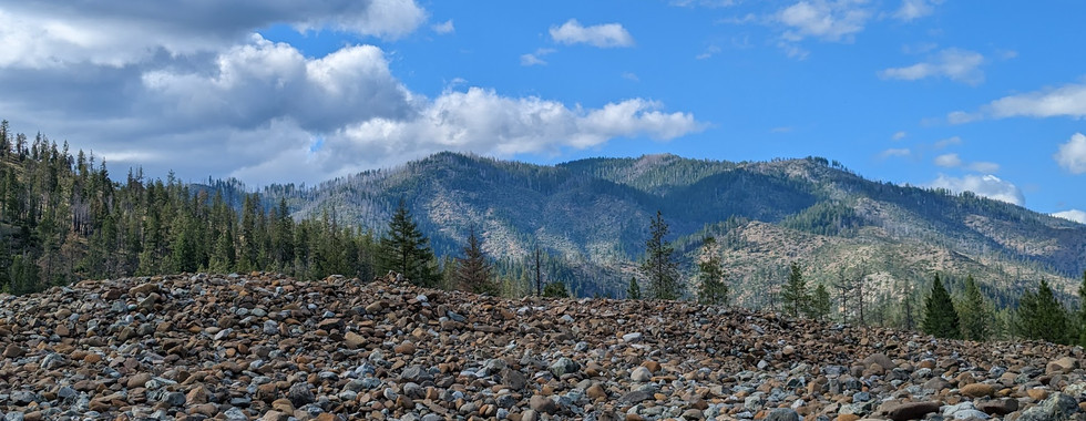
The Klamath-Siskyou has been called the wildest place on the West Coast-- a cornucopia of alpine scenery, snow capped peaks, wild and scenic rivers, and some of the best overland in the Pacific Northwest. Come see why this 11 million acre wilderness been proposed to be a UNESCO Biosphere Reserve.
Route Overview
Trip Length & Season
Adventure Rating: Epic Trip Length: 311 miles, 3-6 days Season: Recommended June thru October to early November, but may vary depending on snow at higher elevation.
Digital Map & GPX Files

Technical Ratings & Terrain
Avg Technical Rating: 2
Peak Technical Rating: 3
Typical Terrain: Much of the track consists of well kept forest service roads. There are some sections of two track, shelf roads (Whiskey Peak), and short sections of bumpier jeep tracks.
Recommended Vehicle / Moto / Adventure Vans
Recommended Vehicle: Stock 4x4
Recommended Moto: A mid-weight bike is recommended for some of the bumpier sections, but skilled riders may be able to handle a big bike on this track. There is a creek crossing at Briggs Creek that may be too deep for motos, especially earlier in the season (take the Illinois River Loop track back to pavement instead). Road 1040 is also recommended to avoid the steep and loose Whiskey Peak jeep trail.
Adventure Vans: Yes! You'll want to take the Road 1040 alternate route to avoid Whiskey Peak Jeep Trail. Sprinters may have issues fording Briggs Creek. Consider Taking the Illinois River Loop alternative track instead.
Fuel, Provisions, and Recommended Gear
Alternative Routes
Road 1040 Distance: Technical Rating: 1-2 Road 1040 is an alternate track specifically for Sprinters and big ADV bikes which may have issues going up and around Whiskey Peak.
Illinois River Lloop
Distance:
Technical Rating: 1-2 Motorcycles and Sprinters may have issues fording Briggs Creek. Use the Illinois River Loop as a means of getting back to the pavement, instead of backtracking via River Road.
Camping Recommendations
Some of our favorite places to camp along the Siskiyou Crest include:
Donomore Meadows
Bolan Lake
Applegate River along road 1040
Whiskey Peak
Tailings River Camp (fantastic swimming hole)
Sam Brown Campground (can be noisy on weekends due to OHVs and motos)
Discovery Points
DP1 - Ashland
DP2 - Mt Ashland
DP3 - Meridian/Siskiyou Crest Overlook
DP4 - Dutchman Lookout
DP5 - Silver Fork Basin
DP6 - Donomore Meadows
DP7 - Donomore Cabin
DP8 - Condrey Mountain Viewpoint
DP9 - Acorn Woman Peak Lookout
DP10 - Applegate River
DP11 - Applegate Lake
DP12 - Whiskey Peak Jeep Trail
DP13 - Whiskey Ridge Viewpoint
DP14 - Harlow Log Cabin
DP15 - Cook & Green Pass
DP16 - Red Buttes Wilderness
DP17 - Klamath River
DP18 - Bolan Mountain Lookout
DP19 - Oregon Caves National Monument
DP20 - Illinois River
DP21 - Little Illinois River Falls
DP14 - Harlow Log Cabin
DP23 - Kalmiopsis Rim Viewpoint
DP24 - Swinging Bridge
DP25 - Chetco Pass
DP26 - Pearsoll Peak Lookout
DP27 - Illinois River Canyon
DP28 - Briggs Creek Crossing
DP29 - Flat Top
DP30 - Chrome Ridge Road
DP31 - Rogue River
Land Managers & Other Resources
Permits & Papers
n/a
Adventure Badge
OTG has partnered with All Roads Taken to offer an adventure badge for this route.
>> Buy your adventure badge today!

Route Details
Aside from the Oregon Shakespeare Festival, southwestern Oregon is often overlooked by folks who live in Oregon and neighboring California. But for the locals who call it home, they know that the Siskiyou Mountains in southern Oregon are an outdoor wonderland, filled with snowcapped peaks, mountain slopes shrouded in emerald green fir and pine, spooky rain forests, and wild and scenic rivers like the Rogue and Illinois. The Klamath-Siskiyou bioregion that spans far northwestern California and southwestern Oregon is rich with incredible diversity in both flora and fauna, and it's been called the wildest place on the West Coast! The Klamath-Siskiyou is home to one of the densest concentrations of pine and fir on earth with at least 36 different species of fir and pine tree. The region is designated by the International Union for the Conservation of Nature as one of only seven Areas of Global Biological Significance on the continent of North America and the Klamath-Siskiyou has been proposed as both a World Heritage Site and UNESCO Biosphere Reserve. The track can be driven in either direction, and can be connected with the Wild Rivers Discovery Trail to the west, of the Steelhead Adventure Trail so the south in the Smith River National Recreation Area. If you're up for real adventure, we recommend creating a loop out of these three fantastic routes that do an excellent job of showcasing the Klamath-Siskiyou. The offical route begins in the charming town of Ashland and quickly heads up the mountain past Mt Ashland Ski Resort. The dirt roads on this section of the trail are wide and well maintained. Be sure to stop at Meridan Overlook (DP3), which provides a great precursor of what's to come in terms of alpine scenery and views-- they will only get better! Next up is the lookout tower at Dutchman Peak (DP4), which affords 360 degree views including the Rogue River Valley, Mt Shasta to the south, the Siskiyou Crest, and you may even be able to make it some of the more distant peaks like Red Buttes Wilderness. The track follows a secondary dirt trail around Observation Peak, which has a number of impressive meadows and views of Mt Shasta along the way. Be sure to stop at Donomore Meadows (DP6), which is perhaps the most scenic alpine meadow along the route-- and a fantastic place to camp later in the season once the mosquitoes have died down. Continue on to Condrey Mountain for some impressive views of the Klamath Mountains to the south, and the Klamath River below. The most ideal way to travel the route is via the Elliot Creek (road 1050) alternative route. Unfortunately, the forest service has erected a gate at the bottom near Applegate Lake. However, it's possible to obtain a permit and the gate code from the Star Ranger District (see the Permits & Papers section at the top for more info), which will allow passage along this section of trail, including vehicle access to the old Harlow log cabin (DP14). Most folks will likely travel around Acorn Women peak and down and around Applegate Lake as a necessity given the locked gate.
The track wraps around Whiskey Peak, and the wide gravel road soon turns into a narrow, steep, and bumpy jeep track that's best suited to 4x4s. Once you wrap around the peak, you'll be back on a nice wide gravel road that brings you to the Whiskey Ridge Viewpoint (DP13). The viewpoint has fantastic views of the craggy peaks of Red Buttes Wilderness just a few miles a way. We recommend stopping and walking over to the viewpoint, as there's a really neat visual legend that you can line up and tells you the names of each peak in the distance. The track climbs up and over Cook and Green Pass dropping down to Highway 96 and the Klamath River. You'll pass through Seiad Valley and burn pavement for a few miles, and right before reaching Happy Camp the track heads back into the mountains. You'll make your way past Bolan Peak (check out the lookout!) and drop down to Oregon Caves National Monument (DP19), which is a great place to rest and explore for a few hours if time permits.
Burn the pavement through Cave Junction and swing a left onto forest road 4201 that parallels the rugged and beautiful Illinois River. The official route takes you up road 4207 to the Kalmiopsis Rim (DP23), which has incredible views of the red stained serpentine that dominates the Kalmiopsis Wilderness. Drop back down, and follow the dirt track that parallels the Illinois. While not at all technical, this is an incredibly bumpy section of trail. You'll huge mounds of old mine tailings that were removed from the hill sides when miners in search of gold blasted the hillsides away with hydraulic canyons. In fact, this stretch of the Illinois and Josephine Creek has produced some of the largest gold nuggets in the state of Oregon! The campsite and deep swimming hole at Tailings River Camp is one of our favorite along the track. The dirt road leads to the pavement of the Illinois River Road, but turns back into dirt within a few miles. Speaking of swimming holes, the one at the Swinging Bridge (DP24) is a local favorite, and can get rather busy on weekends. It's still worth driving down and across the floating bridge that crosses the Illinois. The track continues north through the incredibly rugged Illinois River canyon, before crossing Briggs Creek (DP28). The water at Briggs Creek can exceed 30" earlier in the season if there's still a prevalent amount of snow melt, but is typically 1-2' deep by the time July rolls around. The last section of track past Flat Top (DP29) and Chrome Ridge Road (DP30) is among the most scenic along the track. While you may not get the same views as Whiskey Ridge, the stained red serpentine rock and soils contrasted with the pine and fir creates a surreal environment. And if you're lucky enough to visit after a recent rain or when the clouds and fog are rolling through, it's downright sublime! The track officially ends at Galice Road and the Rogue River (DP31), with options to continue north through the Rogue River Canyon and connect with the Wild Rivers Discovery Trail should you choose.
Gallery


Photos by OTG and OTG Member Tom Taylor.
Terms of Use: Should you decide to travel a route that is published on Overlandtrailguides.com, you do so at your own risk. Always take the appropriate precautions when planning and traveling, including checking the current local weather, permit requirements, trail/road conditions, and land/road closures. While traveling, obey all public and private land use restrictions and rules, and carry the appropriate safety, recovery, and navigational equipment. The information found on this site is simply a planning resource to be used as a point of inspiration in conjunction with your own due-diligence. In spite of the fact that this route, associated GPS track (GPX and maps), and all route guidelines were prepared under diligent research by OverlandTrailGuides.com, the route accuracy and current conditions of roads and trails cannot be guaranteed.


Comments