
Mendocino Backcountry Discovery Trail
- OTG Crew
- Nov 2, 2019
- 7 min read
Updated: Mar 6
If you're looking to get away from the crowds and explore an expansive and rugged wilderness filled with endless dirt roads, then "The Mendocino" (as locals call it) has got you covered! The Mendocino segment of the California Backcountry Discovery Trail, was the very first BDT released in the mid-1990s. Well over a decade before KTM's Backcountry Discovery Routes.
Route Overview
Trip Length & Season
Adventure Rating: Epic Trip Length: 2-3 days, 167 miles Season: Late April - November. If you are going earlier or later in the season, be sure to check snowpack in areas like Hull Mountain, Anthony Peak and Black Butte.
Technical Ratings & Terrain
Avg Technical Rating: 2
Peak Technical Rating: 3
Typical Terrain: Primarily wide dirt and gravel roads. There is mild section that is steeper with some minimal rocks the last 2-3 miles up Hull Mountain. When going to the summit of Hull Mountain, AWD vehicles, Sprinter 4x4s, and adventure bikes should consider staying left at the fork onto the "easy" trail.
Recommended Vehicle / Moto / Adventure Vans
Recommended Vehicle: Stock 4x4 or AWD Crossover with AT tires
Recommended Moto: Mid-weight and big adventure bikes should have no problems on this route.
Adventure Vans: Sprinter 4x4s are good to go.
Fuel, Provisions, and Recommended Gear
Fuel: The general store at Soda Creek (Lake Pillsbury) closed in early 2026. You'll need enough fuel to get you from Upper Lake to Covelo (170 miles). Provisions: Soda Creek Store near Lakes Pillsbury (open late May thru Sept), Black Butte River Ranch and Covelo. Gear: no specialized gear is recommended for this adventure.
Alternative Routes
Deer Valley
Distance: 18 miles
Technical Rating: 2-3
This track allows you to avoid a good chunk of pavement from Upper Lake to Penny Pines on the the southern end of the Mendocino BDT. The route quickly heads into the mountains and follows the ridge that passes through Deer Valley Campground before meeting up with Elk Mountain Road above the "switchback" section connection Middle Creek (CC Camp) to Penny Pines.
Espee Ridge
Distance: 3
Technical Rating: 2
In recent years, the land slide just south of Howard Lake makes passage along road M1 impossible. Espee Ridge road allows travelers to experience the northern portion of the BDT while avoiding the need to backtrack dozens of miles. The key is doing the north section in a counter-clockwise direction. If you starting in Upper Lake and traveling the BDT from south to north, upon reaching Black Butte River Ranch you'll want to take FH7 (east) up the mountain towards Anthony Peak. If you take M1 towards Howard Lake, you may hit the recurring land slide that will not allow you to reach Espee Ridge. By visiting Anthony Peak first, you can continue along roads M4, M2, and then loop back around on M1 heading south towards Howard Lake. When you reach Espee Ridge, the road will take you back up the mountain to road M2, just north of Anthony Peak. From there you can connect with M4 to FH7 and head back down to Covelo. FH7 also connects to the eastern side of the forest. If need to drive back to/through the Sacramento Valley, we recommend taking FY7 east, which is a wide and well graded dirt "forest highway" for most of its length.
Uhl Peak Trail
Distance: 2.5
Technical Rating: 4
This short jeep track is popular among local 4x4 clubs, and connects a barren and exposed ridge line from the upper flanks of Anthony Peak to Uhl Peak before meeting back up with road M2.
Mendocino BDT + Six Rivers BDT Consider linking the Mendocino BDT with the Six Rivers BDT for a week long adventure! The Mendocino BDT ends in Covelo, exactly where the Six Rivers BDT begins. Emerald Triangle Grand Traverse This route combines The Lost Coast Adventure Route with the Mendocino and Six Rivers Backcountry Discovery Trails for a truly memorable and remote expedition in far Northern California. Emerald Triangle Grand Traverse page
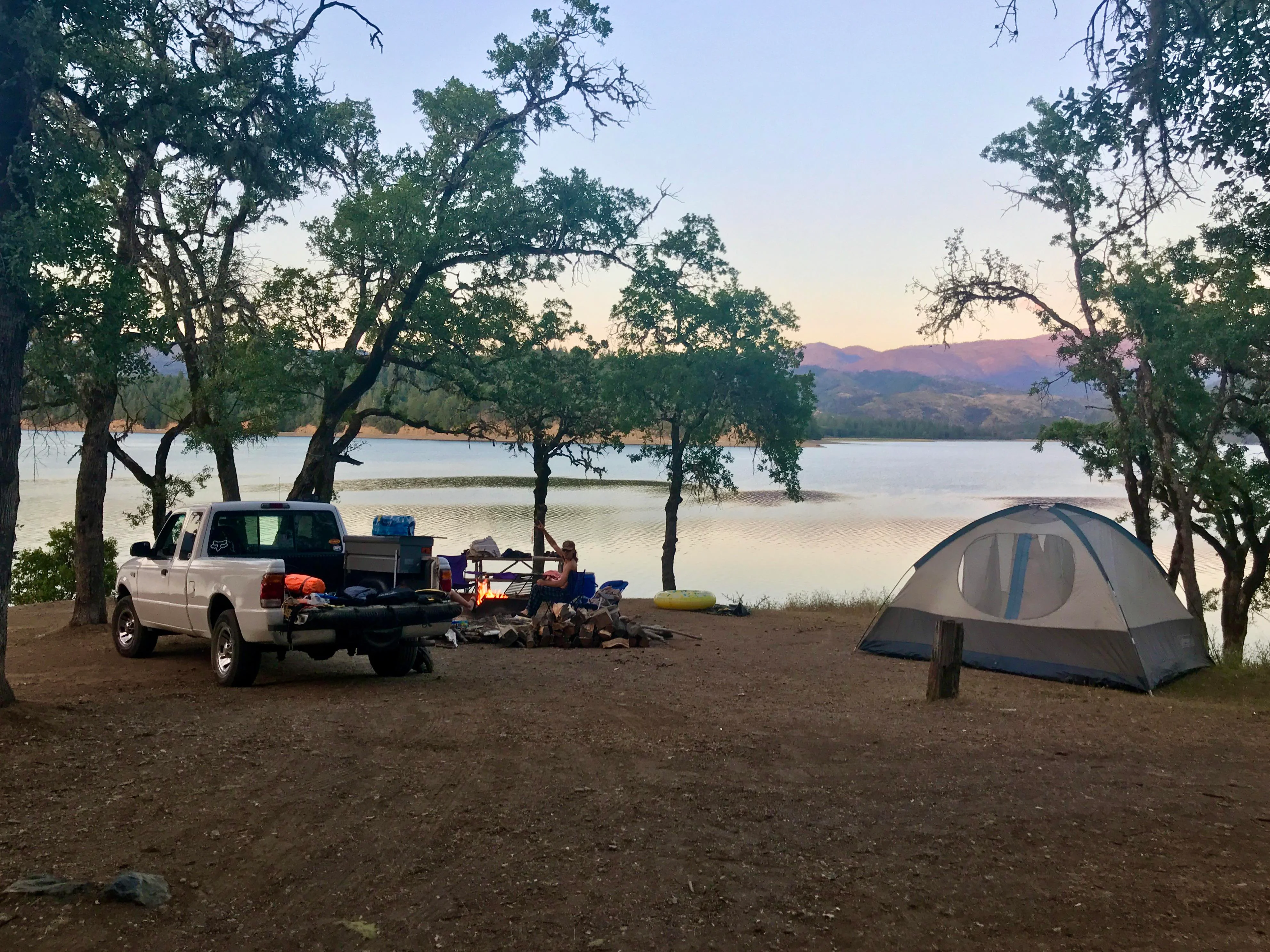
Camping Recommendations
We highly recommend exploring the surrounding wilderness, as there is an endless supply of great camping locations within the Mendocino National Forest. We've listed some of our favorite spots below:
M1 between Hull Mountain and Eel River (numerous spots)
Little Doe Campground (primitive)
Howard Lake Campground (primitive)
Hammerhorn Campground (primitive)
Green Springs Camp (primitive)
Atchison Campground (primitive)
Sunset Point on Lake Pillsbury (if you prefer developed campgrounds with crowds)
Eel River Camp (not the prettiest campground, but it sits right at the confluence of the Eel and Black Butte Rivers)
Discovery Points
DP1 - Upper Lake Historic Downtown
DP2 - Pine Mountain Fire Lookout
DP3 - Eel River
DP4 - Lake Pillsbury
DP5 - Gravelly Airstrip
DP6 - Bloody Rock
DP7 - Hull Mountain
DP8 - James Hull's Grave
DP9 - Milsap Cabin Site
DP10 - Bald Mountain
DP11 - Blue Banks (Serpentine Rock)
DP12 - M1 Golden Hills Viewpoint
DP13 - Black Butte River
DP14 - Black Butte River Ranch
DP15 - Eel River
DP16 - Twin Rocks
DP17 - Keller Place Historic Cabin
DP18 - Black Butte
DP19 - Anthony Peak Fire Lookout
DP20 - Hammerhorn Mountain
DP21 - Howard Lake
Permits, Permits & Other Resources
Digital Maps & GPX Files

Adventure Badge OTG has partnered with All Roads Taken to offer an adventure badge for this route.

Route Description
The Mendocino National Forest is the only national forest in California that isn't crossed by paved road. Despite the fact that there aren't many paved roads in the forest, there's an overabundance of well kept dirt roads and trails, which will delight travelers who like to stray from the main thoroughfares. The updated version of the Mendocino BDT is largely based on the California Backcountry Discovery that is featured on the official Mendocino National Forest map. The Mendocino BDT runs the entire length of M1 from CC Camp (Middle Creek Camp) to the north where it spits out at the confluence of the middle fork Eel and Black Butte Rivers (just east of Covelo). We've taken the liberty of extending the official BDT from its original termination point at the Eel River to include an additional loop through some of the forest's most scenic and remote areas along the northern boundary of the Mendocino National Forest. If you're just getting into overlanding and offroad travel, the Mendocino BDT is a fantastic place to get start with its mostly wide dirt and gravel roads that can be easily navigated with a Subaru or stock 4x4. The route begins in the historic downtown of Upper Lake, before heading north into the forest. As you make your way up the switchbacks of Elk Mountain and into Mendocino National Forest, you'll notice many of the surrounding mountains and hills have succumbed to wildfire. The Mendocino Complex, the largest fire in California history ravaged large swaths of the forest along the southern boundary. The stretch of road from Upper Lake to Lakes Pillsbury is one of the well travelled routes in the forest. While Lake Pillsbury is a great place to relax and cool down from the sweltering mid-summer heat, you can expect crowds, especially in the developed campgrounds that dot the lake. But don't let that scare you away, as Lake Pillsbury is a great place to watch the sunset, take a cool dip, or view a variety of birdlife, including raptors, eagles, and osprey. As you leave Lake Pillsbury, you'll make your way up Hull Mountain (elev. 6873), which dominates the valley below. Hull Mountain rewards the steadfast traveller with numerous views of the surrounding coastal mountains as you make your way towards the summit. The wide dirt road gives way to a very mild technical section of rocks the last few miles up the summit. At the summit you'll find the remains of the old Hull Mountain fire lookout, along with spectacular 360 degree views. The crowds thin out dramatically as you make your way north from Hull Mountain along M1. The track grows wider and much more tame in natured, with the alpine landscape eventually giving way to rollings hills of golden grass dotted with oak trees and chaparral. There are a number of unique geographic areas and points of interest that you'll pass by as you continue north. Check out the lunar scape of moon dust (see POI on your map) just north of Hull Mountain, or one of several historical homesteads along the path. Eventually you'll find yourself passing the Black Butte River Ranch, which is a great place to grab a bite or have a cold beer on their patio. You've made it to the confluence of the Black Butte and Eel Rivers. The Eel provides some nice deep swimming holes, and unlike the the rivers that run through the Sierra, both the Eel and Black Butte are relatively mild in temperature during the warmer months (often low 70s but beware of toxic algae blooms in summer). The BDT makes a final loop around the base of Hammerhorn Mountain before heading to the summit of Anthony Peak, the highest point in Mendocino County. Anthony Peak is the only remaining staffed fire lookout in the Mendocino NF, and if you're lucky, you might just get invited inside! On a clear day you can see Mt Lassen to the east, and the Pacific Ocean to the west. Anthony Peak (elev. 6959) also a favorite location of stargazers, especially when meteor showers occur. The route concludes with a visit to the historic homestead of the family, which includes a maintained cabin the remains of the old apple orchards that the Keller's planted and kept.
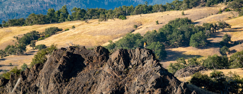
Gallery


Terms of Use: Should you decide to travel a route that is published on overlandtrailguides.com, you do so at your own risk. Always take the appropriate precautions when planning and traveling, including checking the current local weather, permit requirements, trail/road conditions, and land/road closures. While traveling, obey all public and private land use restrictions and rules, and carry the appropriate safety, recovery, and navigational equipment. The information found on this site is simply a planning resource to be used as a point of inspiration in conjunction with your own due-diligence. In spite of the fact that this route, associated GPS track (GPX and maps), and all route guidelines were prepared under diligent research by Overland Trail Guides, the route accuracy and current conditions of roads and trails cannot be guaranteed.